
Some agriculturalists suggest that many crops today are not reaching their genetic potentials. They suggest that genetic breeding is designed to yield as much as 60% more food, but instead, crop management strategies are not living up to the promise – sometimes macro-micro or other variables are not properly managed.
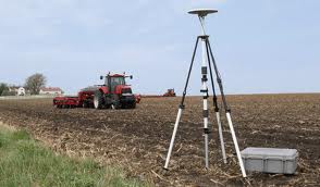
Geospatial technologies can be used for developing landscape topography, the creation of maps that identify and include nutrient levels etc. All too often VR is taken to mean nitrogen management alone for many locations, when considers involving boron, magnesium, sulphur and other factors needs equal consideration.
Geospatial tools have the potential to rapidly increase the level of food production through better understanding of the broad management of agronomic principals.
The baselining of operations is a sound beginning point, and maps and digital records that provide improved documentation can help. The objective of digital record-keeping is to improve the decision-making capability of the operation while decreasing the level of risk.
As farmers work with VR technologies they can expect ttheir knowledge to increase, and the development of management strategies to become less time demanding. Ultimately, improved record management will lead to increasing the value of the operation – and for all producers, that is the challenge.