Asian Surveying & Mapping
Breaking News
Ecolab and ITE partners to harness water management knowledge for Singapore data center engineers
SINGAPORE, 29 APRIL 2024 – Nalco Water, an Ecolab...
NASA releases satellite photos of Dubai and Abu Dhabi before and after record flooding
NASA released photos of parts of Dubai and Abu...
Singapore releases 10-year Geospatial Master Plan
Singapore has launched its new Geospatial Master Plan (2024–33),...
Japan announces plans to launch upgraded observation satellites on new flagship rocket’s 3rd flight
TOKYO (AP) — Japan’s space agency announced Friday a...
Tesla China partners with Baidu for maps to clear FSD hurdle
Amidst Elon Musk’s unannounced trip to Beijing, China this...
ESA opens ideas factory to boost space innovation in Austria
A centre to innovate the design and manufacture of...
Japan’s space agency sets June 30 as third launch date for H3 rocket
The Japan Aerospace Exploration Agency (JAXA) announced Friday that...
S. Korea launches nanosatellite for Earth observation
SEOUL- A South Korean nanosatellite was launched into orbit...
Australian Space Agency funds development of aerospace-grade GNSS receiver
The Australian Space Agency has funded the development of...
Continuity risks for Australian EO data access
A new report details the widespread use of Earth...
memorandum kari

Memorandum signed by the head and head Bakosurtanal Asep Karsidi ANRI M. Menkokesra Asichin witnessed by Agung Laksono and Menristek Suharna Surapranata and the office echelon I, II, and III from both institutions.Head of the Bakosurtanal, Asep Karsidi in his speech stated that the RAN has the task to map the entire territory of Indonesia.

A second agreement was also signed on the same day that seeks to advance the use of geospatial information within the country. 

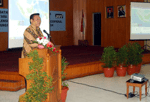
Coordinating Agency for Surveys and Mapping (RAN) and the Development and Education Command Navy (TNI-AL Kobangdikal) signed a Cooperation Agreement. 

Both institutions agreed to hold a Cooperation Agreement in the field of education, research and development of Geospatial Information. 

Conducted by Principal Secretary Penadatanganan Bakosurtanal, Ir. Budhy Andono Soenhadi Kobangdikal MCP and Commander of Navy, Rear Admiral SE Sadiman.