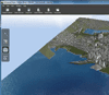
Project Galileo is the next iteration of the LandXplorer product that Autodesk purchased in Sept. 2008. The two-plus years of development work have been focused primarily on the seamless integration of various data types. Paul McRoberts, senior director of infrastructure modeling product line at Autodesk says that this product is an information package, rather than a graphics package, because it allows users to visualize data and information in context.
McRoberts demoed the ease of import of geospatial data, Civil 3D data and BIM models to show an individual building within the greater context of the surrounding city. McRoberts cautioned the audience that too often we show plans at a high degree of realism, which often turn off input and collaboration. The tool was used to sketch in some new infrastructure for planning purposes, with an emphasis on a less than optimised view in order to involve the public.
Of particular interest to the audience was the ability to dynamically interact with the model directly. Manipulating the terrain with immediate feedback was demonstrated in a pond planning scenario, where users have the ability to see the amount of water that will be retained by the pond as well as the amount of earth that would have to be removed. This feedback during the planning and design phase of projects will greatly improve the optimisation of the design, while involving stakeholders.
Autodesk’s target audience for this product include planners, GIS analysts, project managers, and architects. The intent is to help stakeholders better understand infrastructure projects and plans in the context of the built and natural environment.
Visit the Project Galileo web page via Autodesk Labs for more information regarding this project. A downloadable technology preview is available via this same landing page.


