Asian Surveying & Mapping
Breaking News
Australia’s Gilmour Space Technologies ready to launch maiden Eris Test flight the nation’s first orbital launch in over 50 years
Gilmour Space Technologies is the leading launch services company...
Korea’s space agency seeks revision of plan to modify next-gen rockets into reusable system
South Korea's aerospace agency said on Thursday that it...
UAE Space Agency Signs Agreement With Technology Innovation Institute to Execute the Emirates Mission to the Asteroid Belt’s Lander Project
In the presence of His Highness Sheikh Hamdan bin...
Private Japanese lunar lander enters orbit around moon ahead of a June touchdown
A private lunar lander from Japan is now circling the moon, with...
Indian astronaut to travel soon to ISS as part of ISRO-NASA Mission
Prime Minister Narendra Modi said by 2040, an Indian’s...
China issues regulatory framework to support direct-to-device satellite services
HELSINKI — China has released comprehensive regulations for direct-to-device...
Astranis clinches $115 million Taiwan deal despite satellite setback
TAMPA, Fla. — Astranis has signed a $115 million...
UAE and Egypt Strengthen Space Collaboration with New MoU
In a milestone development for Arab space collaboration, the...
Seoul launches 4th spy satellite to boost North Korea surveillance
South Korea’s military now operates an increasingly integrated cluster...
Indonesia seeks space defense cooperation with Japan’s military
Jakarta (ANTARA) - The Ministry of Defense of Indonesia...
indus

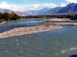
The source of the Brahmaputra, Indus, Salween and Irrawaddy rivers was reported this week from scientists at the Chinese Academy of Sciences (CAS). Using satellite imagery, Liu Shaochuang, a researcher with the Institute of Remote Sensing Applications at CAS reported the findings. Working on the expedition operating between 2007-2010, the project included both field trips and remote sensing tools and technologies.

“Previously, the sources of the four rivers were never clearly designated, and differing accounts regarding their lengths nd drainage areas confused researchers for many years due to restrictions of natural conditions and surveying and mapping technologies, said Liu Shaochuang, a researcher with the Institute of Remote Sensing Applications under the CAS,” reported Xinhua

Accomplishing this work depended upon updated remote sensing technologies. Today, satellite imagery has higher resolution and landscape features and spectral analysis often help to identify and delineate these landscape features.  

The Salween River, “is an international river, originating from Tangula Mountain of the Himalayas in the Tibetan plateau. The Salween then flows southward through Yunnan Province of China, down through Shan and Kayah States in the East of Burma (Myanmar), and along the Thai-Burma border, passing through Kayan and Mon States (Burma), and emptying into the Gulf of Martaban in the Andaman Sea,” as described by Salween Watch.