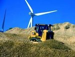

Each day several our mail is filled with new products and services from around the globe. It is becoming obvious to me that measurement is flourishing. Companies like Ubisense, for example, are monitoring and measuring bus movements within garage facilities housing hundreds of buses, as well as tracking movements of heavy duty tractors and excavation equipment.
The new Leica 3D Disto provides detailed 3D measurements through the use of laser scanning that generate points along along surfaces inside buildings and other infrastructure – all in 3D. To top it off, images are also provide at the same time to coincide with these measured points. LINZ, an organisation in New Zealand is responsible for “determining and maintaining the accurate and complete measurements and location of New Zealand’s physical features.“
Did you ever wonder if both land and water could be measured at the same time? The Optech ALTM Airborne Laser Terrain Mapper can do just that. The lidar measuring device provides high quality shoreline terrain measurements along with the water depth near-shore (10 meters depth).
The Department of Surveying and Mapping in Malaysia wants higher quality vertical measurements – elevation. To achieve this it is undertaking to perform high accuracy GNSS measurements. And, the Chinese company FOIF is measuring high precision groundwater levels using GNSS surveying technology as well. Because the measurement of undersea environments creates vast quantities of spatial data, MrSID, a compression software is used to compress data for all of the measured information in marine surveys. Meanwhile, water content reflectometers can measure water content levels in soils – helping farmers to understand water availability for crop production.
These are just a few examples of measurement technologies that are used everyday. Their value is important to a wide variety of geospatial and geomatic functions including infrastructre, construction, farming and agriculture, marine monitoring, water and hydrological work, architecture, plant design and utilities related work.