The Indian Space Research Organization (ISRO) North Eastern Space Applications Centre (NE-SAC) is using unmanned aerial system (UAS), or drone, technology for large-scale mapping and real-time assessment and monitoring activities for various applications.
NE-SAC designed and assembled several UASs, including a hex copter that can carry up to 2.5 kilograms of different sensors such as thermal, multispectral, optical, hyperspectral and LiDAR. The centre also has a ready-to-fly quad copter with an integrated optical sensor, which can capture high-resolution geotagged aerial photos and high-definition videos, and NE-SAC recently added a fixed-wing UAS.
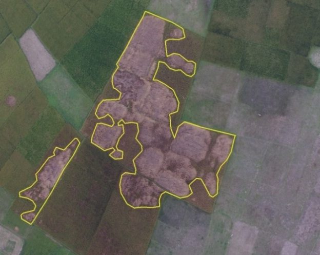
Naramari village of Morigaon District, Assam, India, reported severe infestation of Boro Paddy by the Brown Plant Hopper insect. A 15-minute NE-SAC UAS flight was conducted in the affected area, collecting 0.55 square kilometers of data.


