Asian Surveying & Mapping
Breaking News
HAL to build, market Isro’s SSLV in landmark deal
New Delhi, Jun 20: In a historic move for...
Taiwan developing space capabilities for all-weather imaging
TAIPEI (TVBS News) — Taiwan is advancing its space...
Honda hails successful test of reusable rocket as it looks to get into the space business
Tokyo — Japan's second-biggest carmaker, Honda, has successfully tested...
China’s space program provides larger platform for broader international cooperation
BEIJING -- Experts from China's manned space program said...
India To Launch $1.5 Billion Joint Earth Mission With NASA In July
National Aeronautics and Space Administration (NASA) and the Indian...
Axiom-4 mission delayed again: ISRO confirms Subhanshu Shukla’s ISS spaceflight won’t launch before 22 June 2025
The Axiom-4 mission to the International Space Station has...
Mengzhou spacecraft for China’s moon-landing mission passes landmark test flight
China has completed the inaugural test flight of its...
Space application for ITMA Asia + CITME 2026 opens
Shanghai – Space application for the 2026 edition of...
Yanmar, Chia Tai and XAG Empower Thai Agriculture through Innovation
Bang Nam Priao District, Chachoengsao Province, Thailand – On...
bitsensing Signs MOU with IKIO Technologies to Advance AI-Based Traffic Monitoring on India’s Expressways, Highways and Municipal Areas
Backed by proven success in South Korea and Europe,...

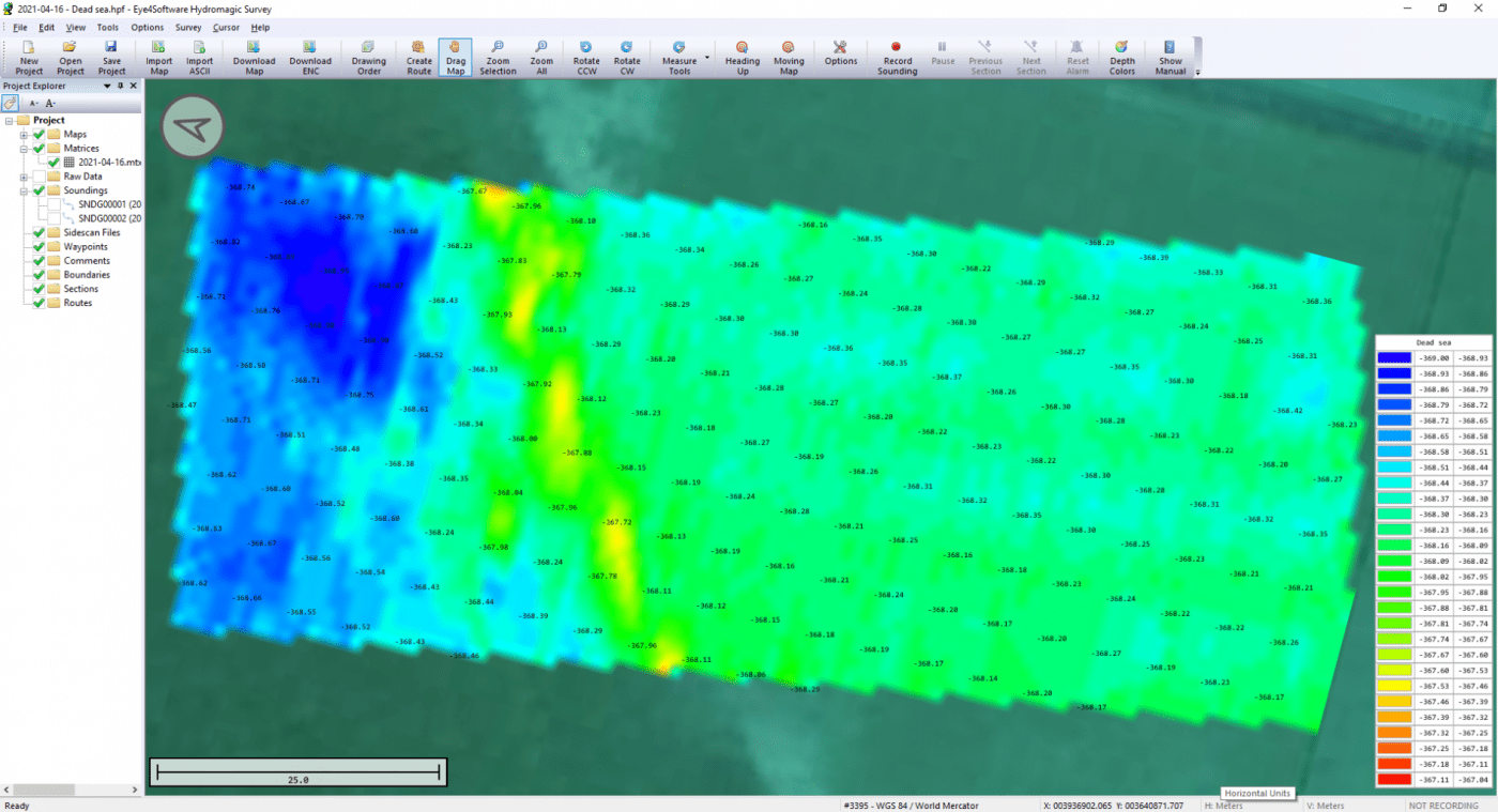
Israeli drone service provider ERELIS recently conducted a number of pilot projects using a drone equipped with a single-beam echo sounder in the Mediterranean and Dead Seas. The data was validated by authorized local surveyors and reports from previous surveys of the same areas by “Michmoret Campus – Faculty of Marine Sciences.” The “reference” bathymetric data was collected using a manned boat and multi-beam and single-beam echo sounders and demonstrated a good match between the results of new drone-based and traditional methods. 

The bathymetric system consisted of a standard commercial DJI drone (UgCS SkyHub onboard computer and terrain following system with radar altimeter) and Echologger ECT400 single-beam echo sounder provided by SPH Engineering, Latvia. For data processing, the Eye4Software Hydromagic software package was employed.

Image Credit: ERELIS