Wednesday, July 22nd, 2015
Cheseaux-Lausanne, Switzerland / Canada, July 22, 2015 — Swiss professional drone manufacturer, senseFly, today announced that its eBee has become the first fixed-wing system to be designated a ‘compliant small UAV’ by Transport Canada—a distinction that moves organisations...
Friday, April 24th, 2015
April 24, 2015 — DroneMetrex is excited to announce that unsurpassed NIR mapping data were captured with the TopoDrone-100:

Wednesday, March 21st, 2012
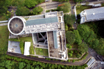
For the first time Singaporean authorities have given permission for a photogrammetric UAV mapping/modeling flight over an important area of the city. In the context of the SEC-FCL (Future Cities Laboratory) project a pilot study is conducted...
Tuesday, March 13th, 2012
With the new 2.4 MAVinci Dektop Release MAVinci introduces a novelity on the UAS market: the advanced Multi Flight Planning Tool for mapping applications. It automatically calculates multiple flight plans to cover areas which exceed the range...

Thursday, March 1st, 2012
Digital airborne cameras have been available on the market for use globally for many years, Without doubt they provide high quality results, have nurtured and created capacity for supporting information gathering through to processing and distribution. By...
Tuesday, February 28th, 2012
ETH-Zurich Assistant Professor Lian Pin Koh has built an autonomous drone that can be used for nature conservation purposes, such as surveying large mammals and monitoring the rainforest. He is excited about the initial results of the...
Wednesday, February 22nd, 2012
Australian-owned AEROmetrex, leader in digital aerial data acquisition and processing, and New-Zealand company Hawkeye UAV, pioneer in commercial Uninhabited Aerial Vehicle (UAV) operations have signed a distributor agreement for AEROmetrex to market Hawkeye-UAV technology and imagery throughout...
Wednesday, February 22nd, 2012
Any MAVinci customer will be able to upload Images into Icaros’ server for Orthophoto and DTM extraction, directly from MAVinci desktop application, creating easy integration and seamless workflow between the two platforms.
Wednesday, February 15th, 2012
Thanks to the Aibot X6 agricultural experts can increase their crop yield, reduce their costs and protect the environment. Agriculturalists have to know which parts of their farmland need what kind of fertilization. UAV drones such as...
Tuesday, December 27th, 2011
Sri Lanka's marine researchers are planning to use aerial and underwater unmanned vehicles with remote sensing technology to study the oceans around the country, officials said. Sri Lanka's National Aquatic Research Agency (NARA) wants to team up...