Asian Surveying & Mapping
Breaking News
Thailand to launch its second Earth satellite next week
Thailand is set to launch it second Earth observation...
Chinese launch startup’s rocket fails during satellite launch
The Chinese launch company Galactic Energy suffered its first...
First Hong Kong-made satellite set to launch in November from Guangdong province, company reveals
The first Hong Kong-made satellite is set to be...
China launches Yaogan 39 remote sensing satellite
China launched a Long March 2D carrier rocket on...
Saudi Arabia publishes maps with new names for ceded islands
A new map published by Saudi Arabia’s General Authority...
US, Saudi Arabia conclude region’s largest-ever counter-UAS exercise
The US and Saudi Arabia conducted the largest-ever counter-UAS exercise...
Study improves accuracy of planted forest locations in East Asia
An international team led by Purdue University scientists has...
Iran, Russia Working On Joint Research Spacecraft
In an interview with Tasnim, the president of the...
France, Bangladesh sign deal to provide loans, satellite technology during Macron’s visit to Dhaka
French President Emmanuel Macron witnessed the signature of a...
Iran, Russia Working on Joint Research Spacecraft
TEHRAN (Tasnim) – Top universities from Iran and Russia...

surveyors

image

Friday, February 24th, 2012

How Cartographers Make Surveyors Look Good

Surveyors are experts at collecting spatial data with high accuracy and precision. But cartographers are masters when it comes to making maps and graphic products that represent surveying information. For users of cartographic products though, how the...

Thursday, February 2nd, 2012

Important Changes to the Registration Process for QLD Mine Surveyors

Due to recent changes to the Queensland legislation pertaining to who can sign statutory mine plans in Queensland, the Surveyors Board of Queensland has adopted the “100 points” system of determining acceptance of the academic requirements for...

Saturday, January 7th, 2012

Philippines – Paje Orders Blacklisting of Erring Cadastral Survey Contractors

Paje’s move came in the wake of initial reports that a number of cadastral survey projects outsourced by the government were incomplete or abandoned by the survey contractors.   “This blacklisting should serve as a warning to all survey...

Tuesday, August 16th, 2011

SuperGeo to Release Facility Management System

Facility Management System, the web GIS system, developed by SuperGeo Technologies, enables users to navigate, edit, and manage facility information through the Internet anywhere and anytime. Cooperated with GIS technologies, this system assists users in integrating, managing,...

Tuesday, August 9th, 2011

New Updated MicroSurvey FieldGenius

MicroSurvey is pleased to announce a major version update to MicroSurvey FieldGenius, the world's most powerful data collection software for land surveyors. FieldGenius 2011 now supports more devices than ever, under a wider variety of hardware configurations –...

Friday, June 24th, 2011

SuperPad 3 Selected by Eximsales in India

SuperGeo Technologies is pleased to announce that SuperPad 3, its full-function mobile GIS software, is selected by Eximsales Company in India. Stepping into the surveying market in 2005 at Kolkata, Eximsales offers devices for mapping measurement, GIS/GPS applications,...

Wednesday, May 18th, 2011

Eagle Point Software – New 2012 Updates to Its AutoCAD Civil 3D Companion Solutions

Eagle Point Software Corporation announced the 2012 release of its AutoCAD Civil 3D software companion solutions: Data Reduction, Designers' Companion, Surveyors' Companion and Pinnacle Series Task Navigator. These 2012 releases are designed to help civil engineering professionals...
Wednesday, March 16th, 2011

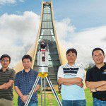
Linkfast Joins Pointools Sales Partner Program in Asia

Linkfast Technology Co., Ltd., a Taiwan-based survey solutions provider of Geographical Information Systems (GIS) data, and a reseller of 3D laser scanning technology, has joined the Pointools Partner Program in Asia. Pointools software is used by project...

Thursday, February 24th, 2011

Geospatial Efficiency – Where Does it Begin?

Efficiency is expected where sustainable development takes place. How efficiency is measured may vary though, particularly where non-tangible benefits arise. Ms Yvonne O. Sowah, President of the Ghana Institution of Surveyors (GhIS) said this past week, that...

Thursday, February 10th, 2011

Brunei – Geospatial Technology Seminar

The Geospatial Technology Update Seminar took place this morning. It was co-organised by the Geographical Information System, GIS Development, Survey Department, Brunei Institution of Geomatics, the Brunei Surveyors, Engineers and Architects Association, PUJA as well as the...

Page 1 of 2 1 2