Asian Surveying & Mapping
Breaking News
Launch of Australia’s 1st orbital rocket, Gilmour Space’s Eris-1, delayed again
Update for 6:15 p.m. ET on July 1: Gilmour Space...
SAASST, UAE Space Agency strengthen scientific partnership
SHARJAH- Prof. Hamid M.K. Al Naimiy, Director of the...
Shubhanshu Shukla to speak to students and ISRO scientists this Friday
Indian astronaut Shubhanshu Shukla will interact with school students...
ISRO hands over 10 advanced technologies to Indian firms in major push for space commercialisation
The Indian Space Research Organisation (ISRO) has transferred ten...
DIGIPIN Launched: India Embraces Geospatial Precision in Digital Addressing
IIT Hyderabad (IITH), in partnership with the Department of...
HAL to build, market Isro’s SSLV in landmark deal
New Delhi, Jun 20: In a historic move for...
Taiwan developing space capabilities for all-weather imaging
TAIPEI (TVBS News) — Taiwan is advancing its space...
Honda hails successful test of reusable rocket as it looks to get into the space business
Tokyo — Japan's second-biggest carmaker, Honda, has successfully tested...
China’s space program provides larger platform for broader international cooperation
BEIJING -- Experts from China's manned space program said...
India To Launch $1.5 Billion Joint Earth Mission With NASA In July
National Aeronautics and Space Administration (NASA) and the Indian...

response

image

Monday, June 6th, 2011

GIS Proves Key to Flood and Fire Management

Geographic Information System (GIS) technology is the key to reducing the social and economic tolls of flood, fire and extreme weather events, according to Gary Johnson, Esri Australia Principal Consultant for Financial Services, speaking at the Australian...
Wednesday, April 20th, 2011

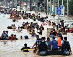
Philippines President Commits to 3D Map to Combat Natural Disasters

Philippine President Benigno Aquino has set asside P1 billion ($23.25 million) to create a 3D map of the entire country. The detailed map is part of an effort to guard and plan against disasters, with 66 provinces...

Wednesday, December 8th, 2010

China to Build Ten Mine Monitoring Demonstration Zones Print

The Chinese Institute of Geological Environmental Monitoring plans to build ten state-level mine geological environment monitoring demonstration zones by the end of Twelfth Five Year plan. These zones will cover northeast, northwest, north and the Yangtze River...