Saturday, September 17th, 2011
The Gautam Buddh Technical University's (GBTU) academic council on Friday gave green signal to introduce MTech in remote sensing from the next academic session. The course will be launched in collaboration with the state government's Remote Sensing...
Thursday, September 1st, 2011
Pakistan plans to work with China, Japan and Europe to expand its network of remote sensing (RS) satellites for use in environment monitoring and natural resource surveys. The Pakistan Space and Upper Atmosphere Research Commission (SUPARCO) announced this...

Wednesday, August 24th, 2011
The source of the Brahmaputra, Indus, Salween and Irrawaddy rivers was reported this week from scientists at the Chinese Academy of Sciences (CAS). Using satellite imagery, Liu Shaochuang, a researcher with the Institute of Remote Sensing Applications at CAS reported...

Friday, August 19th, 2011
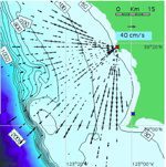
To date, tsunami detection and warning systems have been based on deep-water, pressure-sensor observations that determine changes in sea surface elevation and fluctuation on the coast, which are point measurements. Researchers observed after-the-fact that existing coastal current...
Friday, August 12th, 2011
Jharkhand Deputy Chief Minister Hemant Soren Thursday said that ore reserves in the state would be assessed through remote sensing. "We have prepared maps of iron ore mines by remote sensing and we plan to assess the availabilities...
Tuesday, August 9th, 2011
Ambassador Khan said “As we accomplished this goal of launching PakSat-1R, we will swiftly move on to expand our collaboration with China in related fields of space science and technology”. The launching of the satellite, he said...
Monday, August 1st, 2011
According to forest and environment minister, Ajay Singh Yadav, the forest department has made an agreement with the Haryana State Remote Sensing Application Centrein Hisar, and the National Remote Sensing Centre (NRSC) in Hydrabad, who will be...
Monday, August 1st, 2011
The aircraft glided across the skies over a vast expanse of forest, a sensor strapped to its underside capturing detailed and breathtaking shots, before this only seen in the realm of science fiction.The hyperspectral imaging kit is...
Thursday, July 28th, 2011
Remote sensing solutions provider DMCii has appointed Professor Jim Lynch OBE Director of Forestry to oversee the development of effective tools and partnerships for the implementation of sustainable forestry programmes. Lynch was previously Chief Executive of the UK...