Wednesday, January 25th, 2012
Trimble introduced today cloud-based data management for its SiteFID Gas Monitoring solution used in the environmental services market—the Trimble Connected Community - Environmental. The Connected Community - Environmental provides real-time management and deployment of SiteFID landfill gas surface monitoring...
Tuesday, January 10th, 2012
Health is an important issue not only for human beings, but also for civil infrastructures. Bridge collapses often result in a large number of casualties, as well as negative social and economic consequences, as was seen in...
Sunday, January 1st, 2012
President Benigno Aquino III has ordered the release of P1.6 billion to the Department of Science and Technology (DOST) to enable it to tap “state-of-the-art technology” and improve the accuracy of weather and disaster information-gathering and reporting...
Monday, December 26th, 2011
The interdisciplinary research project CRC TR32: “Patterns in Soil-Vegetation-Atmosphere-Systems: Monitoring, Modelling and Data Assimilation” works on matter fluxes between soil, vegetation and atmosphere (SVA) on a regional scale. In this regard, high quality land use data is...

Thursday, December 22nd, 2011
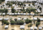
Last year saw extensive flood damage throughout the Brisbane, Australia area. Damage estimates were in the billions of dollars. Infrastructure was destroyed, crops were submerged and the energy industry was impacted significantly. The toll on human life...
Sunday, December 18th, 2011
Cutting-edge technology is enhancing the surveillance capabilities of biosecurity officers from the Department of Agriculture, Fisheries and Forestry (DAFF) and Indigenous ranger groups in Australia’s remote northern region. Community Liaison Officers with the DAFF Northern Australia Quarantine Strategy...

Thursday, October 13th, 2011
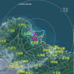
SuperGeo Technologies is authorized to develop a WebGIS to integrate the spatial information related to nuclear disaster. The system provides rich real-time information for the officials to check on maps via the Internet. The precision and reliability of decision-making can...
Thursday, October 6th, 2011
Workshop Monitoring And Management which held by Organization and management section of BMKG. The event was attended by 21 participants, who came from UPT, and the Chief of Station of Meteorology, Climatology and Geophysics.The event is opening...
Monday, September 19th, 2011
A tropospheric depolarization LIDAR is installed at Concordia Base (Antarctica, DOME C, 75° S 123° E). The instrument is "alive" in the frame of the national (Programma Nazionele Ricerche in Antartide) projects TAVERN (ISAC CNR) and ICE-CAMERA...
Saturday, September 17th, 2011
This startling revelation was made by Dr. Krishnaswamy Kasturirangan, former chairman of ISRO and current member of planning commission, during a presentation this evening at the Tata Institute of Fundamental Research (TIFR). The focus of his 45-minute...