Asian Surveying & Mapping
Breaking News
HAL to build, market Isro’s SSLV in landmark deal
New Delhi, Jun 20: In a historic move for...
Taiwan developing space capabilities for all-weather imaging
TAIPEI (TVBS News) — Taiwan is advancing its space...
Honda hails successful test of reusable rocket as it looks to get into the space business
Tokyo — Japan's second-biggest carmaker, Honda, has successfully tested...
China’s space program provides larger platform for broader international cooperation
BEIJING -- Experts from China's manned space program said...
India To Launch $1.5 Billion Joint Earth Mission With NASA In July
National Aeronautics and Space Administration (NASA) and the Indian...
Axiom-4 mission delayed again: ISRO confirms Subhanshu Shukla’s ISS spaceflight won’t launch before 22 June 2025
The Axiom-4 mission to the International Space Station has...
Mengzhou spacecraft for China’s moon-landing mission passes landmark test flight
China has completed the inaugural test flight of its...
Space application for ITMA Asia + CITME 2026 opens
Shanghai – Space application for the 2026 edition of...
Yanmar, Chia Tai and XAG Empower Thai Agriculture through Innovation
Bang Nam Priao District, Chachoengsao Province, Thailand – On...
bitsensing Signs MOU with IKIO Technologies to Advance AI-Based Traffic Monitoring on India’s Expressways, Highways and Municipal Areas
Backed by proven success in South Korea and Europe,...

mitigation

image

Thursday, December 22nd, 2011

Data Intelligence: The Australian Flood Prevention Wall

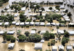
Last year saw extensive flood damage throughout the Brisbane, Australia area. Damage estimates were in the billions of dollars. Infrastructure was destroyed, crops were submerged and the energy industry was impacted significantly. The toll on human life...

Wednesday, December 21st, 2011

Pitney Bowes Business Insight Understands The Cost of Floods to Communities

Floods happen, it is a way of Australian life. What we do to reduce the impact on our communities is what matters. Pitney Bowes Business Insight understands the cost and complexity many local authorities face as they...

Wednesday, November 16th, 2011

Influence of Coastal Vegetation – Tsunami Wave Impact in West Aceh

This study used 180 transects perpendicular to over 100 km on the west coast of Aceh, Indonesia to analyze the influence of coastal vegetation, particularly cultivated trees, on the impact of the 2004 tsunami. Satellite imagery; land cover...

Monday, June 6th, 2011

GIS Proves Key to Flood and Fire Management

Geographic Information System (GIS) technology is the key to reducing the social and economic tolls of flood, fire and extreme weather events, according to Gary Johnson, Esri Australia Principal Consultant for Financial Services, speaking at the Australian...

Sunday, March 6th, 2011

Satellite-Based System to Minimise Earthquake Damage

Earthquake vulnerability tests have been conducted in some 19,000 buildings in Dhaka, Chittagong and Sylhet, the disaster management minister tells parliament. "All the buildings will be examined step by step. Moreover, initiatives have been taken to develop a...

Monday, January 10th, 2011

GI4DM – Geo-information for Disaster Management

Geomatics technologies are able to support management and recovery in the aftermath of manmade and natural disasters. However, disaster management also poses big challenges in all aspects of the geo-information cycle, from data acquisition, processing, management and...