
Tuesday, June 21st, 2011
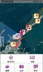
SuperGeo Technologies announces that SuperGIS Mobile Tour 3.0 for Android, its first Android application, is now available. Designed for outdoor mobile tour navigation, SuperGIS Mobile Tour is a mobile GIS application equipped with SuperGIS Mobile Tour Manager,...
Sunday, June 19th, 2011
The TIN (Triangulated Irregular Network) interpolation function now offered by OpenTopography uses Martin Isenburg’s high-performance code for generating raster digital elevation models (DEMs) from mass points via streaming Delaunay triangulation. A TIN model represents the landscape as...
Saturday, June 18th, 2011
A delegation of the General Cartography Department of Turkey will visit Baku in July, according to Azerbaijani State Land and Cartography Committee report. "In connection with measures implied by an agreement on educational, scientific and technical cooperation in...
Saturday, June 18th, 2011
In a bid to obtain data on diverse plant species in the city, the forest department's urban forestry division on Friday launched the first phase of the tree census in institutional campuses. The second phase will cover...
Saturday, June 18th, 2011
Geoscientists can understand the close relationship between people and the environment to contribute towards continued sustainability of the community. Minerals and Geoscience Department Director General Dato' Yunus Abdul Razak said there are laws regulating the practice that should...
Saturday, June 18th, 2011
In the first test of it’s capabilities for forest wildfire mapping, ITRES’ new Thermal Airborne Broadband Imager (TABI-1800) is being used to assist Alberta Sustainable Resource Development (SRD) with fighting active wildfires in the province’s North. This...