Asian Surveying & Mapping
Breaking News
South Korea is converting an abandoned coal mine into a moon exploration testing ground
South Korea is transforming abandoned coal mines into testing...
ISRO to Launch Chandrayaan-5 With Japan, Plans Space Station
Dr. V. Narayanan, Chairman of the Indian Space Research...
Russia and China are threatening SpaceX’s Starlink satellite constellation, new report finds
SpaceX's Starlink satellite constellation is facing threats from Russia...
China and Pakistan agree to fly 1st foreign astronaut to Chinese space station
For the first time, the Chinese space program will train...
ISRO’s “Space on Wheels” offers a peek into Indian Space Programme to students in Karimnagar
The Indian Space Research Organisation (ISRO)’s “Space on Wheels”...
Geospatial led solutions build the foundations for better decision-making
Geo Connect Asia 2025 paves the way for turning...
GEOSA, Singapore Land Authority Launch Achievements of Joint Geospatial System Project
Riyadh, SPA -- The General Authority for Survey and...
Building in Bangkok collapses as powerful earthquake hits southeast Asia
One person has died and 50 were injured in...
Bellatrix Aerospace Partners with Astroscale Japan for Space Debris Removal
Bellatrix Aerospace, a Bengaluru-based space mobility company, has joined...
NSTC announces Pingtung site as Taiwan’s space mission launch center
Taipei, March 26 (CNA) Taiwan's National Science and Technology...

Mapping

Thursday, May 5th, 2011

NAVTEQ Launches its LocationPoint Mobile Ad Network in China

NAVTEQ has launched its location-based mobile ad network, NAVTEQ LocationPoint, in China. This new platform-independent service enables businesses in Singapore and around the world to tap into the fast-developing China market via highly-targeted, relevant and interactive offers...

Thursday, May 5th, 2011

OSGEO Japan Assistance and Support to the Tohoku Region Earthquake

Currently, OSGeo Foundation Japan Chapter members, to actively support disaster assistance and reconstruction assistance as a volunteer. In the far northeast of the earthquake response, OSGeo Foundation, FOSS4G along with widespread use of the tool is very...

Thursday, May 5th, 2011

Indian Research Institute Counts Cost of Blaze

Research data collected from across the country over years, maps plotting endangered tribes and other valuable documents are feared lost in Monday night’s blaze in the Fireproof Spirit Building in the Indian Museum complex. The fire nearly gutted...

Wednesday, May 4th, 2011

GeoPDF Atlas Donated to Japanese Government

Hitachi Solutions, Ltd., as part of its effort to assist in the reconstruction following the earthquake and tsunami in Japan, has donated a TerraGo GeoPDF map atlas to the central Japanese government, disaster response headquarters and local...

Tuesday, May 3rd, 2011

SuperGIS Server 3 to Support Map Cache

SuperGeo Technologies announced that its SuperGIS Server 3 is going to support the map cache function soon for speedy map processing functionality. Developed by SuperGeo Technologies, SuperGIS Server 3, the map server software, enables enterprises to create, manage, integrate, and...
Tuesday, May 3rd, 2011

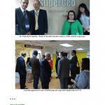
Kuwait Institute for Scientific Research Visit SuperGeo for Geospatial Innovation

SuperGeo Technologies is honored to be visited by Kuwait Institute for Scientific Research (KISR). The two parties had fruitful discussion about the geospatial applications and innovative collaboration by using GIS technologies. KISR was invited by Institute for Information Industry (III),...

Tuesday, May 3rd, 2011

Lookout for Telltale Scars on Hill Terrain – National Remote Sensing Centre

The Indian Space Research Organisation (Isro) has used RISAT, a radar imaging satellite which can penetrate clouds to take pictures, to track down the helicopter of Arunachal Pradesh chief minister Dorjee Khandu. With tremendous pressure on the...

Monday, May 2nd, 2011

Dubai’s GIS Enhances Operations to Support Continued Growth

Dubai Municipality signed an enterprise license agreement (

Monday, May 2nd, 2011

Workshop on GIS Tool Kit for Schools

A workshop on the GIS Tool Kit for Schools will be conducted in Thailand on May 24 and 25, 2011. This workshop is organized by the Geo-Informatics and Space Technology Development Agency (GISTDA) of Thailand within the framework of the...

Friday, April 29th, 2011

ASM Newsletter – April 29, 2011

If you have trouble viewing this newsletter, click here to view in a browser ASM Website Calendar Submit Editorial Cloud-Based Mapping Tools Emerge to Appeal to Enterprise UsersThe move to cloud-hosted Geographic Information Systems seems to be...

Page 50 of 66 1 45 46 47 48 49 50 51 52 53 54 55 66