Asian Surveying & Mapping
Breaking News
Australia’s Gilmour Space Technologies ready to launch maiden Eris Test flight the nation’s first orbital launch in over 50 years
Gilmour Space Technologies is the leading launch services company...
Korea’s space agency seeks revision of plan to modify next-gen rockets into reusable system
South Korea's aerospace agency said on Thursday that it...
UAE Space Agency Signs Agreement With Technology Innovation Institute to Execute the Emirates Mission to the Asteroid Belt’s Lander Project
In the presence of His Highness Sheikh Hamdan bin...
Private Japanese lunar lander enters orbit around moon ahead of a June touchdown
A private lunar lander from Japan is now circling the moon, with...
Indian astronaut to travel soon to ISS as part of ISRO-NASA Mission
Prime Minister Narendra Modi said by 2040, an Indian’s...
China issues regulatory framework to support direct-to-device satellite services
HELSINKI — China has released comprehensive regulations for direct-to-device...
Astranis clinches $115 million Taiwan deal despite satellite setback
TAMPA, Fla. — Astranis has signed a $115 million...
UAE and Egypt Strengthen Space Collaboration with New MoU
In a milestone development for Arab space collaboration, the...
Seoul launches 4th spy satellite to boost North Korea surveillance
South Korea’s military now operates an increasingly integrated cluster...
Indonesia seeks space defense cooperation with Japan’s military
Jakarta (ANTARA) - The Ministry of Defense of Indonesia...

Mapping

Wednesday, March 14th, 2012

GlobIce: Mapping the Movement of Sea Ice

An ESA-funded project to model sea ice dynamics using archived radar data from the Envisat and ERS missions has released its first validated datasets for the Arctic winters of 2004–11. Mapping sea ice displacement is key for...

Tuesday, March 13th, 2012

International Flood Expert to Advise Local Insurers

An international geospatial expert and key figure behind a global flood modelling project will advise Australian insurers on how to manage and assess risk using cutting-edge flood mapping technology.

Tuesday, March 13th, 2012

MAVinci Desktop 2.4: Efficient Multi Flight Planning for MAVinci UAS

With the new 2.4 MAVinci Dektop Release MAVinci introduces a novelity on the UAS market: the advanced Multi Flight Planning Tool for mapping applications. It automatically calculates multiple flight plans to cover areas which exceed the range...

Tuesday, March 13th, 2012

Esri Wins 2012 IBM Beacon Award for Best Industry Solutions for Government

Esri was named winner of a 2012 IBM Beacon Award for Best Industry Solutions for Government in recognition of Esri Maps for IBM Cognos. This...

Tuesday, March 13th, 2012

GEO Announces Call for Participation in GEOSS Pilot with OGC Leadership

The Group on Earth Observations (GEO) has announced a Call for Participation (CFP) in the 5th phase of the Global Earth Observation System of Systems (GEOSS) Architecture Implementation Pilot (AIP-5). The Open Geospatial Consortium (OGC) provides leadership...

Monday, March 12th, 2012

AutoVAZ and NIS GLONASS Agreed On Development of New Products

AutoVAZ and federal net operator “NIS GLONASS” signed an agreement about strategic partnership in sphere of mass introduction of GLONASS technology in car transport. Companies agreed about the joint realization of program “ERA-GLONASS” and about development and...

Monday, March 12th, 2012

Masdar of Abu Dhabi Procures ZephIR 300 Wind Lidars

ZephIR technology has been chosen by both Masdar Power and Masdar Institute of Science and Technology to provide wind measurements in challenging desert conditions in Abu Dhabi. The two ZephIR 300 systems will...

Monday, March 12th, 2012

Russian Federation – Cadastre Development Project

Ratings for the Cadastre Development Project for Russian Federation were as follows: outcomes were satisfactory, the risk to development outcome was low or negligible, the Bank performance was satisfactory, and the Borrower performance was also satisfactory. Some...

Monday, March 12th, 2012

AAM Geocortex Web Directions Workshop: Perth, WA

AAM are holding a Geospatial Web Directions Workshop in Perth. This will be a great opportunity for current users and those interested in Web mapping and Web GIS to see the latest Geocortex technology advancements and tools, hear about...
Friday, March 9th, 2012

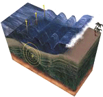
Mapping the Japan Tsunami Disaster in 3D

The Japan Tsunami disaster resulted in a proliferation of mapping and cartographic production. This resulted from the many needs of people to identify and provide emergency services, to enable protective services, assist in geophysical studies and to...

Page 14 of 66 1 9 10 11 12 13 14 15 16 17 18 19 66