Saturday, April 16th, 2011
One of the most common descriptors people use when talking about the sound of an earthquake is "like a freight train." It's easy to understand why when you listen to this clip of Japan's massive 9.0 earthquake....

Saturday, March 19th, 2011
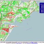
A dynamic map overlay showing the Road Status after the Earthquake in Sendai, Japan, based on the user generated maps from OpenStreetMap has been generated by Pascal Neis, member of the GIScience Research Group of the University...
Wednesday, March 16th, 2011
This article documents a current disaster. Information regarding it may change rapidly as it progresses. Although this article is updated frequently, it may not reflect the most current or official information about this disaster for all areas. Read More

Wednesday, March 16th, 2011
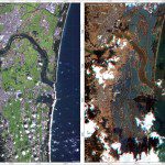
The images were acquired by the German Optical RapidEye and radar TerraSAR-X satellites. They show Torinoumi on the eastern coast of Japan before the disaster on 5 September 2010 and after the tsunami on 12 March 2011....
Wednesday, March 16th, 2011
Kei Furuta, managing director of Equinix Japan says the company has arranged for priority deliveries of diesel fuel so that both data centers can continue running through the blackout periods that the local utility Tokyo Electric Power...
Tuesday, March 15th, 2011
SuperGeo Technologies, the leading global provider of complete GIS software and solutions, announced that Japan Hiroshima University selected SuperPad 3 through Information & Science Techno-System Co., Ltd. (ISTS), SuperGeo’s reseller in Japan. Located in Hiroshima, Japan,...
Tuesday, March 15th, 2011
A Japan Trends Map is now available from Esri. The map visualizes a heat map of aggregated reports or reports categorized by property damage, hazards, evacuations, power outages, or...

Sunday, March 13th, 2011
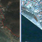
Detailed satellite images of the territory of Japan were received, where a series of earthquakes were registered on March 11 in its north-eastern parts. According to the Main Meteorological Service of the country the 8.9 magnitude earthquake...
Saturday, March 12th, 2011
The magnitude 8.8 earthquake that jolted northeast Japan was caused by a tectonic upheaval that created offshore faults stretching for hundreds of kilometers from Iwate Prefecture to Ibaraki, seismologists said Saturday. Satoko Oki of the University of Tokyo's...
Saturday, March 12th, 2011
In response to the devastating Japan earthquake and tsunami, Esri is providing assistance to a myriad of organizations involved in the disaster response. The company is working closely with both domestic and international...