
Thursday, December 9th, 2010
At this year's Autodesk University event Autodesk unveiled their next-generation 3D city modeling tool with the working name of Project Galileo. This large-scale modeling tool will be available soon as a working beta software release via Autodesk...
Wednesday, December 8th, 2010
The worldwide market for Geospatial Information Systems (GIS) is forecast to grow 65 percent over the next five years, representing a compound annual growth rate of 10.5 percent, according to a new ARC Advisory Group study. Emerging...
Monday, December 6th, 2010
Shell Malaysia has reinforced its commitment to sustainable development by increasing its annual grants from RM300,000 to RM500,000. Its chairman, Anuar Taib, said the grants, currently in the third year, would be used to fund 13 projects...
Sunday, December 5th, 2010
Years of wrangling over land, compensation and environmental impact have become a regular feature of many projects aimed at developing modern India. High-profile disputes include plans for a second airport on protected wetlands to service India's financial...

Thursday, November 18th, 2010
China has slowly re-opened the door for development of mega hydro projects. This follows a period where such development was limited due to environmental concerns. A number of projects have recently been given approval to proceed including...

Friday, October 29th, 2010
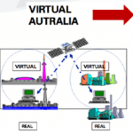
The idea of Virtual Australia is to build a fully interoperable interactive 3D photo-realistic simulation of the natural and built environment on all scales down to 2cm, including internal spaces and...

Friday, September 10th, 2010
The concept of intelligent infrastructure involves the combination of sensors, network connectivity and software to monitor and analyze the inputs for more efficient operations. This concept meshes nicely with advancements in...
Tuesday, January 8th, 2008
At festival’s end, tired pilgrims attending the Sunning of the Buddha Festival in the Chinese city of Xining (the capital of Qinghai Province), board the Qinghai-Tibet Railway train and start the 26-hour trip home to...
Wednesday, May 16th, 2007
A new urban planning system has been commissioned in Seoul. The entire South Korean capital can now be visualised down to street level. City planners are using the system as part of the development approval...