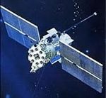
glonass
Monday, September 12th, 2011
Includes the Samsung system to track the GPS, GLONASS, GALILEO satellites, 136 satellite channels; built-in SIM card, the mode switch at any time, GSM module built to support customer self CORS; dual battery intelligent switching, built-in dual-battery warehouses, large-capacity lithium...
Tuesday, September 6th, 2011
Leica Geosystems is pleased to announce the new version 4.1 of its Leica Spider software suite including Leica GNSS Spider, Leica SpiderWeb and Leica SpiderQC. The market leading software introduces full GPS & GLONASS satellite correction signals...
Wednesday, August 31st, 2011
The launch of a Soyuz-2.1B rocket with a Glonass-M navigation satellite aboard, scheduled for the night of August 25-26 from the Plesetsk space center, has been pushed back to sometime between September 1 and 10. News of...
Sunday, August 21st, 2011
Prestigio’s Executive director for European and CIS countries Yuri Antoshkin has reported that while working on Prestigio GeoVision GV5135 they particularly oriented on Russian market but a number of European markets demonstrated an unexpected interest to double-system...
Wednesday, August 10th, 2011
Russia has secured Nokia's backing of its GLONASS satellite navigation system, a major step forward for the country's technology toward securing the number two global position after GPS. GLONASS, as well as European space program Galileo and China's...

Wednesday, August 3rd, 2011
The Russian Space Agency is presenting a request to the government to increase the level of funding to the agency. The request is interesting because of the information included, but also draws a line in the sand...
Wednesday, August 3rd, 2011
Russia has planned to launch three rockets (LV) from its Baikonur space center in Kazakhstan in August including GLONASS, Russian media report. According to ARMS-TASS, Russian Federal Space Agency will launch the rocket Proton-M from the center...
Monday, August 1st, 2011
The NavX NCS is the most flexible and capable RF signal generator for GPS, Galileo, GLONASS and SBAS constellations on the market. With up to 9 L-band frequencies and 108 channels, it redefines the current state-of-the-art in...
Monday, August 1st, 2011
China says it successfully launched another satellite for its indigenous global navigation and positioning network system. The satellite was placed into a geostationary orbit by a Long March-3A rocket after a Wednesday launch from the Xichang Satellite Launch...
Thursday, July 21st, 2011
Beneath the surface of this tropical paradise in the city of Townsville on Australia’s Sunshine Coast lies a still hidden maze of tunnels and underground bunkers, once said to be used by General Douglas MacArthur. Learning...