Friday, November 4th, 2011
Located in the Province of Macerata, Marche Region (the central part of Italy), Recanati is a famous city with long history and culture development. Under the Municipality of Racanati (Comune di Recanati), the department of Service Planning...
Thursday, October 27th, 2011
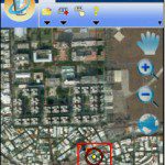
SuperGeo announces that SuperGIS Mobile Tour 3, the mobile GIS application designed for tourism, has been updated and enhanced. SuperGIS Mobile Tour 3 is the application especially for tour navigation, enabling administrators to develop a system integrating GPS...
Thursday, October 27th, 2011
SuperGeo announced that the branch company of Aurecon Company in South Africa has purchased SuperGIS Desktop 3 for their GIS/Data Management Department, which is planning to cooperate with SuperGeo’s South Africa distributor, Spatial Perspective for the purpose...
Monday, October 24th, 2011
For better management and planning of coastal areas and their resources, Gujarat government is implementing a Geo-Spatial Information System (GIS) development project. "The development of GIS for coastal areas is a key component of Integrated Coastal Zone...
Wednesday, October 19th, 2011
SuperGeo Technologies is pleased to announce the latest sales achievement in Japan, where SuperGIS Desktop 3 has been selected by National Institute of Infectious Diseases to improve the research outcome and...
Wednesday, October 19th, 2011
The complete map server functions in SuperGIS Server 3 can efficiently create, manage, integrate, and publish multiple GIS services, which assist enterprises in centrally managing...
Monday, October 17th, 2011
Northern Territory utility Power and Water Corporation has today provided a demonstration of their new asset management system, at Australasia’s leading spatial conference, Ozri 2011. Underpinned by world-leading Geographic Information System (GIS) technology from Esri Australia and business...

Thursday, October 13th, 2011
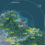
SuperGeo Technologies is authorized to develop a WebGIS to integrate the spatial information related to nuclear disaster. The system provides rich real-time information for the officials to check on maps via the Internet. The precision and reliability of decision-making can...
Friday, October 7th, 2011
Esri released a new global basemap service designed to highlight your data. The Light Gray Canvas map is now available at arcgis.com and ArcGIS Explorer Online. The Light Gray Canvas map features an overall soft gray color for...

Thursday, October 6th, 2011
SuperGeo Technologies, the leading global provider of complete GIS software and solutions, today announced that its latest fully functional mobile GIS software, SuperPad 3.0a, is officially launched to global market. SuperPad 3 consists of...