Asian Surveying & Mapping
Breaking News
South Korea is converting an abandoned coal mine into a moon exploration testing ground
South Korea is transforming abandoned coal mines into testing...
ISRO to Launch Chandrayaan-5 With Japan, Plans Space Station
Dr. V. Narayanan, Chairman of the Indian Space Research...
Russia and China are threatening SpaceX’s Starlink satellite constellation, new report finds
SpaceX's Starlink satellite constellation is facing threats from Russia...
China and Pakistan agree to fly 1st foreign astronaut to Chinese space station
For the first time, the Chinese space program will train...
ISRO’s “Space on Wheels” offers a peek into Indian Space Programme to students in Karimnagar
The Indian Space Research Organisation (ISRO)’s “Space on Wheels”...
Geospatial led solutions build the foundations for better decision-making
Geo Connect Asia 2025 paves the way for turning...
GEOSA, Singapore Land Authority Launch Achievements of Joint Geospatial System Project
Riyadh, SPA -- The General Authority for Survey and...
Building in Bangkok collapses as powerful earthquake hits southeast Asia
One person has died and 50 were injured in...
Bellatrix Aerospace Partners with Astroscale Japan for Space Debris Removal
Bellatrix Aerospace, a Bengaluru-based space mobility company, has joined...
NSTC announces Pingtung site as Taiwan’s space mission launch center
Taipei, March 26 (CNA) Taiwan's National Science and Technology...

geospatial data

Wednesday, March 16th, 2011

Philippines NEDA to Launch Caraga Regional GIS Center

According to NEDA-Caraga regional director Carmencita S. Cochingco, as the socioeconomic planning agency of the region and the secretariat of the Regional Development Council (RDC), their office will spearhead the institutionalization of a geographic information system (GIS)...

Tuesday, March 8th, 2011

SuperGeo Spin off EMCT for Environmental Consulting Services

SuperGeo Technologies announces a new spinoff company, EMCT, to provide specialized environmental consulting services using GIS technologies. The newly established company, Environmental Management Consultant Technologies Inc. (EMCT), used to be a project team focusing on the consulting services...
Thursday, February 24th, 2011

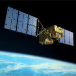
Japan’s Space Contributions Helping the World

In a recent interview Keiji Tachikawa - President, Japan Aerospace Exploration Agency (JAXA) spoke about the many contributions that Japan is making in terms of space exploration and satellite imaging and sensing. These include an asteroid explorer that...

Wednesday, February 23rd, 2011

Safe Software – Worldwide Events for Advancements in Spatial Data Transformation

Safe Software, the global leader in spatial data transformation, announced today the kick-off of the FME 2011 World Tour, a customer event series that will be held in 25+ cities worldwide starting this March. Co-hosted with Safe...

Friday, February 18th, 2011

Trialling Ocean Temperature Forecasts for Fish Farms

Marine scientists are trialling the first near-shore water temperature forecasts to assist Australia’s aquaculture farm managers contending with rising ocean temperatures. While land farmers have used seasonal forecasting for nearly a decade, marine farmers in south-east Australia...

Thursday, February 10th, 2011

Need for a Global Geospatial Information Management System

The need for a mechanism that would integrate the various geospatial organisations and agencies together with their valuable geospatial data around the globe remains high on the agenda. The United Nations has been working on this initiaitive...

Monday, December 20th, 2010

Carlson Survey 2011 Embedded AutoCAD Just Released

Get the combined package of Carlson’s feature-rich, intuitive surveying office software with the AutoCAD® engine with Carlson Software’s just released Carlson Survey 2011 Embedded AutoCAD. The affordable Carlson Survey 2011 Embedded AutoCAD version comes with the AutoCAD...

Friday, November 5th, 2010

LizardTech Unveils GeoExpress 8

GeoExpress 8, which enables geospatial professionals to compress and manipulate satellite and aerial imagery, introduces the MrSID Generation 4 (MG4) format for compression of raster data, adding support for multispectral data, alpha channels and improved mosaicking. With...

Page 4 of 4 1 2 3 4