Asian Surveying & Mapping
Breaking News
China Launches Earth Observation Satellite Gaofen-13 02 for Remote Sensing
China on Friday sent a new Earth observation satellite...
ISRO to conduct young scientist programme in Bengaluru
The Indian Space Research Organisation (ISRO) is organising a...
Egypt launches second remote-sensing satellite from China
The Egyptian Space Agency’s CEO, Sherif Sedky, announced the...
Israeli-developed DRONE DOME to secure Dubai from aerial attacks
Rafael Advanced Defense Systems Ltd. is supplying the system...
China launches 2nd Horus remote-sensing satellite for Egypt (video)
China has launched a second remote-sensing satellite for Egypt,...
China obstructs new subsea cable to Taiwan
Southeast Asia-Japan Cable 2 connecting Japan, Taiwan, Hong Kong,...
Scientific collaboration between China and US key to tackling climate change, experts say
Efforts to combat climate change bore the brunt of...
ISRO Receives India-US Jointly Built NISAR Earth Observation Satellite, Begins Preparations For Launch
US space agency NASA has handed over NISAR earth...
ISRO conducts parachute deployment tests on rail tracks for Gaganyaan Mission
Indian Space Research Organisation (ISRO) has conducted Rail Track...
OceanX helps Riyadh boost best up-and-comers in GEOINT
The Saudi Space Commission has given OceanX the difficult...

flood mapping

image

Wednesday, August 19th, 2015

Palawan, Philippines Receives Flood Hazard Maps

The Department of Science and Technology’s (DOST), under its Disaster Risk and Exposure Assessment for Mitigation (DREAM) project, turned over the copy of the province’s digital terrain model, digital surface model and orthophotograph to the Palawan and...

Thursday, September 6th, 2012

The Philippines Begin 3D Mapping of the Entire Country

Later this month, scientists and researchers in the Philippines will begin mapping the entire country's topography in 3D using LIDAR equipment from Canada-based Optech. The P200 million project will create a high-resolution map of the country in...

Thursday, September 29th, 2011

Queensland Inquiry Told Flood Mapping Amiss

Queensland's Flood Inquiry has heard that attempts to protect future developments from flooding are hampered by a lack of flood mapping. A proposed Queensland building code would require a minimum building height above flood levels. But the...

Thursday, February 24th, 2011

Insurer Attacks Lack of Flood Mapping

Insurance Australia Group has likened the lack of adequate flood mapping to a national infrastructure problem, with many home owners unable to secure flood cover because of the state of existing data. The country's biggest general insurer...

Wednesday, February 2nd, 2011

Web Application Combines Mapping and Analysis for Australia Floods

Esri developed a newly launched web application that provides mapping and analysis to enhance Australia flood information supplied through the Ushahidi social network. The network allows people to report incidents via SMS, e-mail, or the web. The...

Thursday, January 20th, 2011

Give Us Flood Data, Insurers Say

Queenslanders lack flood insurance available to other Australians because local governments have failed to provide detailed flood mapping data, according to the Insurance Council of Australia (ICA). The council says there is far greater flood coverage in...

Tuesday, January 18th, 2011

Australia Flooding – Online Trend Mapping

This map uses trend analysis to visualize community reports related to the flooding in Queensland. The Ushahidi social network allows anyone to report incidents via SMS, e-mail or the web. You can view all categories to understand...
Tuesday, January 18th, 2011

AAM Modeling Aids Australia Flood Crisis

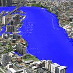
AAM’s 3D Flood Simulation of Brisbane was used extensively by Australian and Global media during the recent flood crisis in Brisbane. The flood level simulations were produced interactively in 3D. This was a very effective way of communicating...

Tuesday, January 18th, 2011

Vietnam Flood Forecasting Needs More Funds

The technology is available for flood-mapping in Viet Nam but little progress has been made due to a lack of capital to pursue the project, says Professor Nguyen Dinh Duong, head of the Institute of Geography's Department...