Asian Surveying & Mapping
Breaking News
Nuri rocket successfully completes KAIST’s next-gen satellite mission
The Korea Advanced Institute of Science and Technology (KAIST)...
President Lai reviews progress on first indigenous satellite constellation
President Lai Ching-te said developing space technology is a...
Japan’s iQPS lines up eight SAR launches
ST. LOUIS — Japan’s Institute for Q-shu Pioneers of...
UAE Astronauts Promote AI and Collaboration in Space at GITEX Europe
The Arab world’s first astronaut, Hazzaa Al Mansouri, and...
New species of space-adapted bacteria discovered on China’s Tiangong space station
Scientists have discovered a previously unknown strain of microbe...
Isro’s 101st mission fails as PSLV-C61 suffers third-stage anomaly
India’s latest Earth observation satellite mission faced a setback...
Iraq’s First Fully Solar-Powered Village in Kulak Is Now Operational
ERBIL, Kurdistan Region – May 20, 2025 — The...
Australia’s Gilmour Space Technologies ready to launch maiden Eris Test flight the nation’s first orbital launch in over 50 years
Gilmour Space Technologies is the leading launch services company...
Korea’s space agency seeks revision of plan to modify next-gen rockets into reusable system
South Korea's aerospace agency said on Thursday that it...
UAE Space Agency Signs Agreement With Technology Innovation Institute to Execute the Emirates Mission to the Asteroid Belt’s Lander Project
In the presence of His Highness Sheikh Hamdan bin...

emergency

image

Friday, March 9th, 2012

Australia Floods Call Geospatial Technology to Action

Australia is once again experiencing flooding and it is expected that flooding will result in nearly $1 billion of damage. Although waters have receded in some places, more rains are expected over the next few days and...

Saturday, December 3rd, 2011

PenBay Solutions Releases its Building Navigator Widget for Esri Flex Viewer 2.4

Designed for the Esri Flex Viewer 2.4, the Building Navigator widget allows users to click on a building footprint and drill down inside the building to view floors, spaces, and other data layers.

Saturday, November 19th, 2011

Gillard to Unveil Ambitious Asia Disaster Response Plan

The plan drawn up by Australia and Indonesia - which hosts the East Asia Summit beginning in Bali today - would involve countries including China and the US instantly sharing sensitive satellite images, damage and casualty reports...

Wednesday, December 8th, 2010

China to Build Ten Mine Monitoring Demonstration Zones Print

The Chinese Institute of Geological Environmental Monitoring plans to build ten state-level mine geological environment monitoring demonstration zones by the end of Twelfth Five Year plan. These zones will cover northeast, northwest, north and the Yangtze River...
Saturday, October 30th, 2010

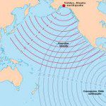
Indonesia – Tsunami Warning System Monitoring

During the past week we have learned that the existing Tsunami Warning Systems in Indonesia have been vandalised. This act may have contributed toward the greater number of deaths as, any...