Asian Surveying & Mapping
Breaking News
China Launches Earth Observation Satellite Gaofen-13 02 for Remote Sensing
China on Friday sent a new Earth observation satellite...
ISRO to conduct young scientist programme in Bengaluru
The Indian Space Research Organisation (ISRO) is organising a...
Egypt launches second remote-sensing satellite from China
The Egyptian Space Agency’s CEO, Sherif Sedky, announced the...
Israeli-developed DRONE DOME to secure Dubai from aerial attacks
Rafael Advanced Defense Systems Ltd. is supplying the system...
China launches 2nd Horus remote-sensing satellite for Egypt (video)
China has launched a second remote-sensing satellite for Egypt,...
China obstructs new subsea cable to Taiwan
Southeast Asia-Japan Cable 2 connecting Japan, Taiwan, Hong Kong,...
Scientific collaboration between China and US key to tackling climate change, experts say
Efforts to combat climate change bore the brunt of...
ISRO Receives India-US Jointly Built NISAR Earth Observation Satellite, Begins Preparations For Launch
US space agency NASA has handed over NISAR earth...
ISRO conducts parachute deployment tests on rail tracks for Gaganyaan Mission
Indian Space Research Organisation (ISRO) has conducted Rail Track...
OceanX helps Riyadh boost best up-and-comers in GEOINT
The Saudi Space Commission has given OceanX the difficult...

coast

image

Thursday, May 28th, 2015

Hazard Map of Tamil Nadu Coast Proves Cooperative Effort

The coastal villages of the south Indian state of Tamil Nadu were heavily impacted by the 2004 tsunami in the region as well as cyclones. To help the region prepare for future devastating disasters, an international effort...

Sunday, June 22nd, 2014

Digital Maps of the Kerala Coast Coming Soon

Digitisation of Kerala coast being carried out by the Hydrographic Survey Wing of the Ports Department is set for completion by the year-end. Conducted primarily for purposes of coastal navigation, coastal regulation zone (CRZ) calculation and security...

Thursday, March 20th, 2014

Clark Labs Receives Grant to Map Coastal Habitats at Risk for Shrimp Farm Conversion in Southeast Asia

Clark Labs has received a grant from the Gordon and Betty Moore Foundation to create a baseline map of coastal habitats and the distribution of shrimp mariculture in Vietnam, Cambodia and Thailand. The analysis is based on...

Monday, March 10th, 2014

Drone Beams ‘Mind-blowing’ Coastal Views of Warrnambool

A coastal landscape mapping project using aerial drones is adding a new dimension of insight to Deakin University research. Ballarat venture Victorian UAS Training has spent the week at Warrnambool’s foreshore with its unmanned aerial vehicle (UAV),...

Thursday, July 25th, 2013

Shipwreck Search in South Australia Relies on 3D Mapping

A team of shipwreck hunters have turned to cutting-edge 3D mapping technology to locate sunken vessels along the South Australian coastline… without getting their feet wet.

Thursday, July 25th, 2013

Mapping Wind Resource Potential in Asia

Most of the world's wind resources are in the ocean, and much of that lies on the continental shelves close to our population centers. Asia is a prime target for near-shore wind development, given both its large...

Monday, February 18th, 2013

Sensors to Monitor Entire Coast of Tamil Nadu

The entire Tamil Nadu coast will come under surveillance with the launch of a chain of static sensors in the next seven to 10 days, according to Inspector-General, Coast Guard (Region East), Commander Satya Prakash Sharma. Sharma told...

Monday, June 11th, 2012

Tsunami Sensors Installed in Lingayen Gulf

Pangasinan coastal residents may now be alerted in case a tsunami is generated by a strong earthquake in the West Philippine Sea. Julius Galdiano, acting head of the Philippine Institute of Volcanology and Seismology (Phivolcs) seismic station...

Friday, March 9th, 2012

Mapping the Japanese Tsunami to Prepare for Future Events

The 2011 Tohoku tsunami was Japan's deadliest in more than 100 years. Despite an extraordinary level of preparedness by the Japanese, the tsunami caused more than 90 percent of the almost 20,000 fatalities last March. Georgia Tech...

Thursday, February 23rd, 2012

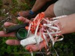
Australia Begins Large-scale Mapping of Debris on its Shores

Scientists from Australia’s national science agency, Commonwealth Scientific and Industrial Research Organisation (CSIRO), are setting out to survey Australia’s 35,000-kilometre coastline to measure marine debris and its impact on sea life. The work is part of the...

Page 1 of 2 1 2