bathymetry
Wednesday, December 14th, 2011
The idea for LINZ contracting the collection of some bathymetric LiDAR data came about for a number of reasons; to measure the performance of the latest Airborne Laser Bathymetry (ALB) systems; to collect data in Wellington Harbour...
Wednesday, August 31st, 2011
Under it’s five-year Indefinite Delivery Indefinite Quantity (IDIQ) contract with US National Oceanic andAtmospheric Administration (NOAA), Fugro Pelagos Inc. have commenced surveying operations aroundthe Aleutian chain’s Krenitzin Islands, Alaska in late July 2011. This 36 day program of...

Friday, August 19th, 2011
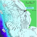
To date, tsunami detection and warning systems have been based on deep-water, pressure-sensor observations that determine changes in sea surface elevation and fluctuation on the coast, which are point measurements. Researchers observed after-the-fact that existing coastal current...
Wednesday, July 6th, 2011
The Joint Airborne Lidar Bathymetry Technology Centre of Excellence (JALBTCX), has announced Fugro Senior Survey Manager Nigel Townsend, as a 2011 recipient of the LCDR Peter Johnson Award for Survey Best Practice.
Thursday, June 9th, 2011
Airborne Lidar Bathymetry specialists, Fugro LADS Corporation, based in Adelaide, Australia have successfully completed acceptance trials of their new Fugro LADS Mk 3 Airborne Lidar Bathymetry (ALB) system and has been awarded a project by the New...
Wednesday, April 6th, 2011
Untitled document Fugro announced today that it has signed a 5-year contract with the National Oceanic and Atmospheric Administration’s (NOAA) Coastal Services Center...
Sunday, March 20th, 2011
Bathy DataBASE now works with Oracle Spatial 11g utilizing the GeoRaster and geo point cloud data structures for storage. Oracle Spatial has been specifically designed to meet the needs of advanced geographic information system applications and is...
Wednesday, February 9th, 2011
The Geological Survey of India brought out a Publication entitled Seismotectonic Atlas of India and its Environs, authored by S. Dasgupta, P. Pande, D. Ganguly, Z. Iqbal, K. Sanyal, N.V. Venkataraman, S. Dasgupta, A. Roy, L.K. Das,...
Friday, June 11th, 2010
LiDAR is another tool in the surveyor’s toolbox. It is capable of providing a three-dimensional X,Y,Z position with a possible accuracy of 5 cm.. The key components of aerial LiDAR instruments include:
