Process Petabytes in Minutes
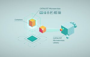
MARKHAM, Ontario, Canada – CATALYST, a PCI Geomatics brand, today introduced CATALYST Microservices, a library of geospatial workflows and algorithms optimized to process Earth image data on the cloud at scale.
“The photogrammetric science and remote sensing algorithms that our clients have relied upon for more than 30 years to extract meaningful information from their airborne and satellite image data are now accessible through CATALYST Microservices to eliminate waste in the data pipeline while offering unprecedented scalability,” said Kevin Jones, Vice President of Product and Marketing at CATALYST.
Applicable to more than 70 aerial and satellite sensors, CATALYST products integrate powerful image analysis, photogrammetric and radiometric processing, and information extraction capabilities for professionals, researchers, developers, and large production operations.
“We developed CATALYST Microservices to solve the biggest challenge facing geospatial professionals today – how to cost effectively process at scale the petabytes of image data being captured by an ever-increasing number of remote sensing platforms,” said Dan Watt, Chief Technology Officer at CATALYST. “CATALYST Microservices is an evolution of our Professional and Enterprise products to optimize Earth image processing in the cloud.”
CATALYST Microservices makes low-latency, high-refresh image processing a reality. By leveraging public cloud services, Microservices can process thousands of images covering large geographic areas in a fraction of the time it would normally take on a distributed server-based system.
CATALYST has automated and simplified the cloud workflow with Microservices to maximize timeliness and cost effectiveness. Microservices eliminates the costly and time-consuming transfer of data from the data center by shifting the processing workflow directly to the cloud service where the imagery is stored. Microservices can even access images from different clouds – Amazon Web Services and Microsoft Azure, for example – and integrate them into a single workflow.
CATALYST Microservices then taps into the enormous parallel computing power of the cloud to securely process the imagery. Processing costs are predictable and directly attributable to the work being done.
“CATALYST Microservices offers the same science-based geospatial solutions that users expect, but now through a highly scalable delivery mechanism that reduces a lot of waste in the processing pipeline directly in the cloud where the data already resides,” said Dan Watt, Chief Technology Officer, CATALYST.
For a CATALYST Microservices demonstration, please visit; https://catalyst.earth/products/catalyst-microservices/
About CATALYST
CATALYST is a PCI Geomatics brand, which has been introduced to put our rich technology for processing Earth imagery into the hands of decision makers. CATALYST provides proven algorithms rooted in photogrammetry and remote sensing to offer engineers, environmental managers, and other professionals accessible earth data measurements on a reliable basis derived with leading edge, scalable software solutions and platforms.
