Montreal, Canada, June 9th, 2020 – SimActive Inc., a world-leading developer of photogrammetry software, announces the release of Correlator3D version 8.5. The new version allows users to share and visualize projects in the cloud. It also features new tools for the calibration and processing of multispectral imagery.
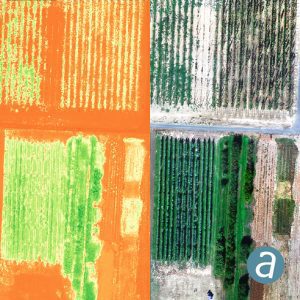
Specifically, results can be exported to the cloud directly from the software interface, and shareable links are automatically created for online visualization. Moreover, calibrated reflectance panels and sun sensors can be used to produce reflectance maps, with multispectral bands perfectly registered.
“Our software attracts a variety of clients, with a wide range of needs”, said Louis Simard, CTO at SimActive. “This new version brings advantages to customers having data exploitation requirements such as online viewing, and to users processing imagery from highly sophisticated sensors.”
About SimActive
SimActive is the developer of Correlator3D™ software, a patented end-to-end photogrammetry solution for the generation of high-quality geospatial data from satellite and aerial imagery, including UAVs. Correlator3D™ performs aerial triangulation (AT) and produces dense digital surface models (DSM), digital terrain models (DTM), point clouds, orthomosaics, 3D models and vectorized 3D features. Powered by GPU technology and multi-core CPUs, Correlator3D™ ensures matchless processing speed to support rapid production of large datasets. SimActive has been selling Correlator3D™ to leading mapping firms and government organizations around the world, offering cutting-edge photogrammetry software backed by exceptional customer support. For more information, visit www.simactive.com.
