Asian Surveying & Mapping
Breaking News
Australian Space Agency funds development of aerospace-grade GNSS receiver
The Australian Space Agency has funded the development of...
Continuity risks for Australian EO data access
A new report details the widespread use of Earth...
China launches new remote sensing satellite
JIUQUAN, April 15 (Xinhua) -- China on Monday launched...
7.4-Magnitude Earthquake Strikes Taiwan
A major, 7.4-magnitude earthquake struck the eastern coast of...
Tata Deploys Its Geospatial Satellite In Space on Space X’s Falcon 9 Rocket
THIRUVANANTHAPURAM: Tata Company launched India's first private commercial satellite...
Taiwan’s Formosat-8 Satellite Set for Launch by 2025
The Taiwan Space Agency has announced progress on the...
Iranian Scientists to Build Satellite Constellation for 2 Simultaneous Missions
The scientists at the knowledge-based company had previously succeeded...
China provides geospatial intel and other military support to Russia, US says
The US has warned its European allies that China...
Japanese lunar lander company ispace raises $53.5 million in stock sale
WASHINGTON — Japanese lunar lander developer has raised $53.5...
Esri and Prince Sultan University Advance GIS Education Through Strategic Partnership
Memorandum of Understanding with Institution Enhances GIS Curriculum and...

April 23rd, 2019
Four Ways Maptitude 2019 Saves You Time & Money

NEWTON MA (USA) – Business analysts need to quickly manage and share their maps and data within their team. Franchisors and retailers need their maps to be updated with their latest corporate data. Hospitals and banks need the most up-to-date demographic information. Maptitude 2019 makes it easier than ever to meet these needs. Here are 4 key areas where Maptitude 2019 will prove to be critical to your organization:

  1. Simple File Management: No more layer saving. No more window saving. Just a simple single file for managing and sharing each project. Maptitude 2019 also now supports auto-saving in case you lose your work or forget to save it, and file-locking to prevent accidental file overwriting by other users.
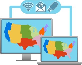
    Simple file management
  2. Data Linking & Updating: No more importing/copying your tables into Maptitude. Continue managing your data in Excel or SQL Server and use linking to update your maps with any changes in your external tables. Maptitude 2019 now supports linking for boundaries as well as for pushpin locations.
  3. Report Customization: Do you need a specific list of demographics in your reports? Do you need to list the ZIP Codes in each of your areas? The new Report Settings ensure you can see the data that are critical to your analysis.
  4. Software and Data: Maptitude 2019 ships with the most up-to-date geographic and demographic information available.
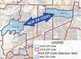
    Maptitude 2019 includes the most up-to-date data

There are many more improvements in Maptitude 2019! Please contact the Maptitude Sales Team with any questions.