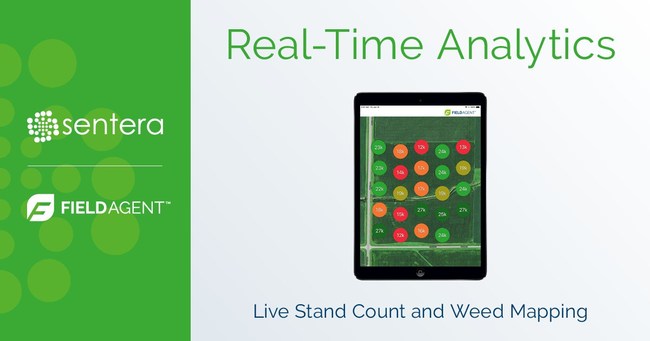
MINNEAPOLIS – Sentera FieldAgent now delivers instant plant population and weed pressure reports in the FieldAgent™ mobile app, while the drone is still in flight. Agriculture professionals can obtain up to 100 times more in-field measurements versus manual scouting methods and get better coverage all across the field. No memory card or post-flight processing is required. The analytics results are delivered live, as the drone flies.

“Our two most widely-used analytics products can now deliver answers to our customers in real-time,” said Eric Taipale, Sentera CEO. “In-field scouting is about accurately assessing field conditions, and giving scouts, agronomists, and advisors that data to drive the best decisions for their customers. We’re making this process more efficient and more productive for our users.”
Logan Cautrell, mobile developer at Sentera explains, “When the drone begins capturing data, users immediately see the results right in the app. The immediacy, coverage rate, and accuracy will make our customers more efficient and give them a broader picture of the field.”
Real-time Analytics. In-field Results.
Real-Time Analytics showcases the combined flexibility and power of the DJI SkyPort architecture, the Sentera AGX710 sensor, and Sentera’s expertise in machine learning and computer vision technology. For ag professionals, this means access to the fast, easy, and complete stand count and weed pressure data. A user simply programs FieldAgent to autonomously scout a field and the system captures 1-2 images per acre, runs the analytics in real-time, and instantly reports the data back to the user’s mobile device, right at the field edge. Calculations happen within seconds and results are delivered instantly.
Using DJI SkyPort, Sentera is able to run analytics on the high resolution, native image product in real-time, as opposed to competitive systems that either run analytics on lower-resolution video, wait for images to download one-by-one, or require post-processing.
Real-Time Analytics is supported on DJI M200 and M210 systems equipped with Sentera AGX710 sensors and are currently offered for corn, soybeans, and potatoes, with additional crop-compatibility being added.
Automated Analytics
Over time, even more of Sentera’s 20 different analytics products will be available in real-time, helping users achieve greater efficiencies with some of their most tedious and labor-intensive tasks. “With FieldAgent’s Real-Time Analytics, scouts can ground truth areas of interest and instantly see results,” said Greg Thompson, director of sales at Sentera. “It allows a complete, integrated scouting mission to be completed before the drone even lands, expediting delivery of insights – something the industry has been seeking.”
Watch the 40-second video!
Pricing and Availability
FieldAgent’s Real-Time Analytics is an included feature of the AGX710 sensor. Real-Time Analytics will be available April 2019. The solution is compatible exclusively with Sentera’s AGX710 sensor and DJI Matrice drone series.
Learn more about FieldAgent’s Real-Time Analytics at a dealer near you, or click here to view Sentera’s website.
About Sentera
Sentera is a leading supplier of integrated analytics and sensors for precision agriculture. Sentera makes it easy for users to integrate in-field real-time data with many digital ag platforms. Sentera’s equipment has flown tens of millions of acres all over the world, and the company processes and manages terabytes of new data for its customers every year. For more information, visit www.sentera.com.