Asian Surveying & Mapping
Breaking News
Intermap Announces $1 Million Program in Malaysia and Business Updates
DENVER – Intermap Technologies (TSX: IMP; OTCQB: ITMSF) (“Intermap” or...
From Kuala Lumpur To Singapore: Malaysia’s High-Speed Rail Resurgence Sparks China’s Pan-Asia Vision
The Malaysian government is once again working on building...
Japan’s Synspective successfully launches fourth SAR satellite
Synspective, the Japanese provider of Satellite/Synthetic Aperture Radar (SAR)...
South Korea’s Joowon Industrial Selects Aeva 4D LiDAR for Automated Power Line Inspection Program
MOUNTAIN VIEW, Calif. & SEONGNAM CITY, South Korea- Aeva®...
Synspective’s SAR Satellite, StriX-3, Successfully Reaches Its Target Orbit and Spreads Its Wings
TOKYO, 2024, March 13 – Synspective Inc., a SAR...
Indian Prime Minister Narendra Modi Commissions Genesys Digital Twin Map Stack in His Parliamentary Constituency
Mumbai: The Prime Minister of India, Mr. Narendra Modi, recently...
Geo Connect Asia 2024 to unveil geospatial’s transformative power
Geo Connect Asia (GCA) is set to return to...
Iran launches ‘domestically developed’ imaging satellite from Russia
The launch of Pars 1 is fourth this year,...
Astranis relocating hobbled debut satellite from Alaska to Asia
TAMPA, Fla. — Astranis is moving its debut satellite...
Asia space race heats up as China, Japan and India reach for the stars
After another year of US aeronautics company SpaceX dominating...

February 1st, 2019
BigData Earth Releases a New Web Mapping, Analysis and Reporting App on Exposure Management

Sydney, Australia – BigData Earth has just released a new web App on location-centric exposure management specific to emergency and insurance applications.

The new App combines web mapping, analysis and reporting together, and takes advantage of the cloud-based big data and analytics platforms and foundational Location Profile APIs (on property location and hazard risk information) the company has built over the past few years. The geographic coverage of the new App includes Australia and the Contiguous US.

The App contains two levels of exposure analyses:
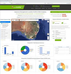
  • Broad-level exposure analysis: For an Area of Interest (AOI), the App can quickly calculate how many addresses and/or estimate how many people are located within potential at-risk areas (Figure 1).

Figure 1

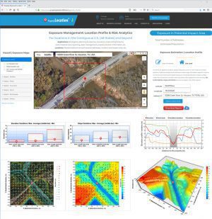
  • Site-level exposure analysis: For an interested site or address, the App produces a wide range of location-specific metrics on the environment and hazard exposure, including elevation, slope, surface water flow directions, vegetation, climate-warming trend, demographics, and housing. Up to 100 metrics, maps and charts are readily generated and reported in seconds (Figure 2).

Figure 2:

The new web App has been hosted by two big data and analytics platforms:

Customization and enhancement of the App is ongoing in response to different geographic coverage, new datasets, client’s requirements and tailored analyses.

BigData Earth ( http://www.bigdataearth.com/) is a data science/technology R&D company creating innovative Location-centric Business Applications worldwide using Geospatial Big Data Analytics, Global Earth Observation and Cloud Computing