Athens, Greece, and Brussels, Belgium 2nd June 2022 – Plexscape, which brings satellite imagery and terrain data into AutoCAD, is partnering with drone surveying company Inflights, giving civil engineers both the bigger-picture for preliminary design and now also ultra-detailed drone surveying data for precision construction.
Plexscape’s flagship product is Plex-Earth, which is primarily used to scout out suitable areas and for fast conceptional planning via georeferenced satellite and aerial imagery with terrain data. As such it’s a firm favorite for instantly seeing the bigger picture for ideas and inspiration, picking the best angles and avoiding errors.
Inflights offers a variety of drone surveying solutions offering centimeter-scale up-close detail of existing structures and landscapes, making it ideal for the later stages of projects.
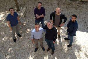
Shoulder to shoulder; Plexscape CEO Lambros Kaliakatsos left, and Inflights CEO Hugo De Blauwe on the right, at Plexscape headquarters, Athens, 5th May 2022
PIONEERING PARTNERSHIP
Both companies can rightfully claim to be pioneers within their respective fields. Plexscape has a string of ‘firsts’, such as the first SaaS plug-in and the first to bring orthorectified satellite imagery into AutoCAD, while Inflights is the world’s first platform to obtain, process and professionally analyze drone data globally.
Another similarity of the two companies is that both are driven by expert CEO founders. Inflights CEO Hugo De Blauwe is an aerospace engineer and private pilot by training, while founding CEO of Plexscape is Lambros Kaliakatsos, a software developer and experienced civil engineer of larger-scale projects.
Both of them seek a more sustainable world where engineers can see and design for the real world, without the time, risk and expense of traveling.
GOING BEYOND GOOGLE
Plexscape’s flagship product Plex-Earth and its free sibling Plex-Earth Lite can both connect AutoCAD with Google Earth. The paid version also offers easy and affordable access to satellite and aerial imagery from premium providers, such as Airbus, Maxar, Nearmap and Hexagon, along with terrain data from Google and Cesium. Adding a drone image and data provider was the obvious next step for Plexscape, but they have held back until today, waiting for a mature and reliable solution. They now see Inflights as that winning solution, as Inflights has solved the scaling problem of covering a big world with many drone pilots each covering a small region.They have done this by building a global drone pilot community, each of them being the business owners of their local entity.
The knowledge of local pilots carries many advantages, ranging from recognizing the best weather windows, to knowing the local laws and regulations for flying drones over various types of locality and structure. The biggest advantage might even be the most obvious one, being close to the location drastically reduces the travel time and cost. Inflights’ credo summarizes this well: “We want our pilots to fly rather than drive” Bringing such professionals into the fold of a large, reputable company creates a potential win-win for both pilots and their engineering clients.
The new partnership with Plexscape, who have been Autodesk Authorized Developers since 2010, will help realize that potential because engineer clients are something Plexscape already has plenty of. Their products have long been perennial favorites on both the AutoCAD and BricsCAD app stores.
Visit https://plexearth.com and https://inflights.com for more information on their products and services.
ABOUT – Inflights is a platform to obtain, process and analyze drone data. Inflights is aiming to make it more cost effective to get highly-accurate 3D measurements anywhere in the world. This is done via a global network of drone pilots who perform flights and upload the resulting data onto their platform, allowing consistent results with expert processing and analysis.
Plexscape is a software company committed to bridging the gap between design and the real world. Plex-Earth, their flagship product, was the first cloud-based software ever created in the CAD market, and is today one of the most popular tools in the Autodesk App Store, being used by thousands of engineers in over 120 countries worldwide on a daily basis. For more information on Plex-Earth visit www.plexearth.com.
