Terra Drone has successfully conducted visual inspection of flare stacks for Chile’s state-owned energy company ENAP. In this project, three flare stacks – each about 70m tall – were inspected in 45 minutes using drones. This proved to be significantly more cost-effective and quicker, than the conventional method, of engaging the services of a professional photographer, in a manned helicopter.
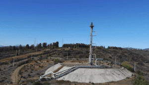
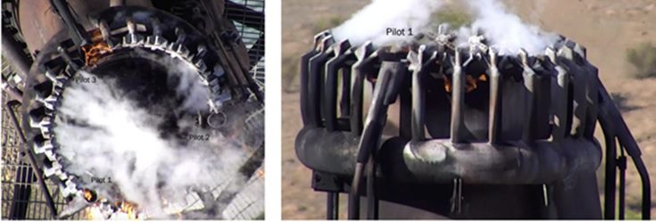
ENAP inspects their flare stacks once every three years, but now wants to conduct more frequent inspections, to ensure optimum performance during operations. Terra Drone used a DJI M210 RTK drone mounted with 2 cameras – a Zenmuse Z30 (zoom camera) and a Zenmuse X5S (high-resolution camera) – for this activity. The drone captured the images of the flares from different angles to facilitate an inspection report that would show each part’s status in terms of cracks, deformity, and integrity.
“In the future, we see a large potential in the European market to implement our technology and experiences gained. There are many benefits and applications of drones that will attract oil and gas companies to adapt them in their daily operations,” said Toru Tokushige, CEO of Terra Drone Corporation.
About Terra Drone Europe
Terra Drone Europe bundles extensive knowledge and experience in asset inspections, geodesy, topographic surveying(Visual / LiDAR), and 3D visualisation into one company. In November 2018, Skeye became part of the Terra Drone group and changed its name to Terra Drone Europe in March 2019. The company is headquartered in the Netherlands and has offices in The Netherlands and the United Kingdom. For more information, please visit https://terra-drone.eu/en/
About Terra Drone Corporation (JAPAN, HQ)
Terra Drone, established in 2016, is one of the largest industrial drone solutions providers in the world. The company’s head office is located in Tokyo, Japan. Terra Drone offers clients high-end drone-based solutions, with the latest cutting-edge technologies embedded and supported by industry professionals. For more information, visit https://www.terra-drone.net/en/. Terra Drone Indonesia is focused on providing solutions in the oil & gas, mining, construction, infrastructure and power sectors.
