Asian Surveying & Mapping
Breaking News
Australia’s Gilmour Space Technologies ready to launch maiden Eris Test flight the nation’s first orbital launch in over 50 years
Gilmour Space Technologies is the leading launch services company...
Korea’s space agency seeks revision of plan to modify next-gen rockets into reusable system
South Korea's aerospace agency said on Thursday that it...
UAE Space Agency Signs Agreement With Technology Innovation Institute to Execute the Emirates Mission to the Asteroid Belt’s Lander Project
In the presence of His Highness Sheikh Hamdan bin...
Private Japanese lunar lander enters orbit around moon ahead of a June touchdown
A private lunar lander from Japan is now circling the moon, with...
Indian astronaut to travel soon to ISS as part of ISRO-NASA Mission
Prime Minister Narendra Modi said by 2040, an Indian’s...
China issues regulatory framework to support direct-to-device satellite services
HELSINKI — China has released comprehensive regulations for direct-to-device...
Astranis clinches $115 million Taiwan deal despite satellite setback
TAMPA, Fla. — Astranis has signed a $115 million...
UAE and Egypt Strengthen Space Collaboration with New MoU
In a milestone development for Arab space collaboration, the...
Seoul launches 4th spy satellite to boost North Korea surveillance
South Korea’s military now operates an increasingly integrated cluster...
Indonesia seeks space defense cooperation with Japan’s military
Jakarta (ANTARA) - The Ministry of Defense of Indonesia...

March 23rd, 2020
“Flattening the Curve” Analysis Added to U.S. Spread of COVID-19 Map

St. Paul, Minnesota – This afternoon, Minnesota based nonprofit SharedGeo updated its online COVID-19 information map by adding two new features. In addition to the time lapse view of the virus spread across the United States by county since early March, now available is a national map and by state graphs showing progress toward “flattening the curve”.
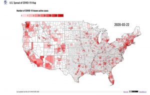
In announcing these developments, SharedGeo indicated this public service effort was underway out of concern many Americans were failing to take the situation seriously. Consequently, it hoped that by visually demonstrating to citizens the rapidly expanding nature of the COVID-19 virus pandemic in the U.S., individuals and organizations would take to heart the warnings, precautions and preventive measures requested by the Centers for Disease Control and Prevention and others in the medical and Public Health sectors. SharedGeo will update these displays going forward as source data is refreshed.

To view the maps, graphs, and learn more, go here: www.uscovid-19map.org.

About SharedGeo: SharedGeo is a Minnesota 501(c)3 nonprofit dedicated to helping government, nonprofit, education, and corporate entities use mapping technologies and share geographic data for the public good. Past and current project partners include federal, state, tribal, county, municipal, nonprofit, and corporate entities. www.sharedgeo.org