DUBAI, United Arab Emirates – DJI has been at the forefront of providing innovative drone-solutions for industries, making a positive impact in more than one sector. The energy industry has already been benefitting immensely from UAV technology and will surely continue doing so in the future. There are many companies using drones to conduct inspections of their solar panel fields, power lines, gas & oil plants and wind turbines.

Drones can be used to provide real-time information about the conditions of power plants and enable quick and efficient interventions in case of malfunctions.
Wind turbines, for example, have blades that easily wear out over time and therefore need annual inspection. Before the advent of drones, this was done by operators rappelling from the blades and conducting close-up inspections. Today the entire operation is much cheaper and safer thanks to drones, which can provide close-up and detailed images of the blades; the intervention is done only if there is actual damage! The incredible zoom power of the Mavic 2 Zoom has proven to be extremely useful for this purpose.
The Oil & Gas industry can also benefit immensely from drone-based solutions, which can cut costs and facilitate operations. UAV inspections are fast and affordable, and can be customized to the needs of the industry thanks to intuitive software offered by DJI. When needing to find the best option to cater to specific needs, it can be very useful to work with a consulting agency. AirWorks, an official DJI dealer located in Dubai, offers enterprise solutions for companies wishing to implement drone-solutions in their operations.
The DJI Phantom series provides simple, high altitude facility surveying, as well as close proximity of vertical inspection. Using these systems, teams can identify structural weaknesses, identify leaks and scan for hot spots so that remedial actions can be taken promptly.
DJI solutions can be deployed on solar panel farms. Thermal cameras such as the ZenMuse XT 2 or the one mounted on the Mavic 2 Enterprise Dual can help inspectors and operators identify temperature anomalies, allowing to single-out and substitute problem panels quickly and ensuring energy production is kept at maximum levels. The Zenmuse can be mounted on any of the DJI Matrice Series Drones, ensuring more than 30 minutes of flight time; this means large sites can be inspected in a single flight, making the operations even more time-efficient. Another excellent combination to use is the DJI Inspire 2 with the Zenmuse X3 or X5. Inspectors can use the 4K videos recorded to make a thorough assessment of the solar farms and act accordingly.
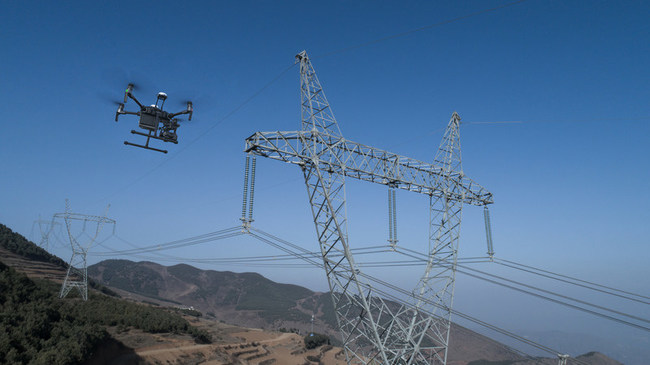
Finally, DJI drones can be deployed for inspecting power lines that cover vast areas of land. Their height and dispersion make them difficult to maintain and monitor using traditional methods; this is where drones can truly make a difference!