The awards recognize higher education institutions for unique and outstanding applications of the Concept3D platform. This year the five categories include: Best Data Feed Integration, Best Campus Safety Initiative, Best Admissions Integration, Most Digitally Accessible Campus Map, and Best Interior Mapping. Honorable mentions were given for Best Green Initiative, Best Virtual Tour, Most Prepared Initiative, and Best Use of Webcams.
“It was quite a challenge to pare it down to the final award winners because there are so many unique applications happening in the higher education space, where interactive campus maps can be used for a wide variety of uses and by different departments,” said Concept3D CEO, Gordon Boyes. “It’s really exciting to see how the higher education professionals are able to use the technology to serve their communities and to note how the awards reflect higher education trends that we’re seeing across the board, from greater digital accessibility to IoT.”
Below are the winners of Concept3D’s 2019 Most Innovative Map awards:
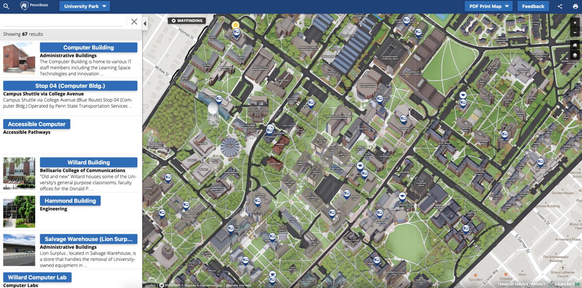
Penn State University launched interactive campus maps for the main University Park campus and 21 of the Commonwealth Campuses, making Penn State one of the largest university interactive mapping systems. Penn State integrated a unique data feed into its maps that shows the availability of computer stations at computer labs across multiple campuses. Using the map, students can quickly find available computer stations closest to their location as well as see how many computer stations are available in real-time.
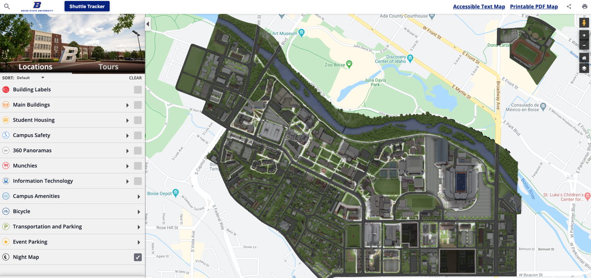
Boise State University showcased its commitment to safety and security this year with the integration of a new toggle-on Night Map feature, a 3D map overlay that makes it easy for students, staff and visitors to find preferred, well-lit night routes as well as resources including emergency phones. Boise State’s Night Map also highlights Public Safety Dispatch Centers, Emergency Blue Light and Refugee Phones, and AED locations. Each item has a display box that further explains the exact location of the service and provides additional information.
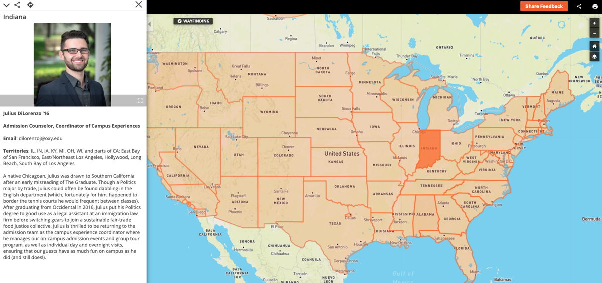
In 2019, Occidental College integrated a new feature to help students around the country find the right point of contact for the Los Angeles-based campus. The “Locate Your Admissions Counselor” option can be switched on, taking students to a map of the United States. The map is sectioned off primarily by state, but in some cases, large metropolitan areas or regions are also featured. A potential student simply has to click on their location to view the appropriate admissions contact complete with background information and a photo.
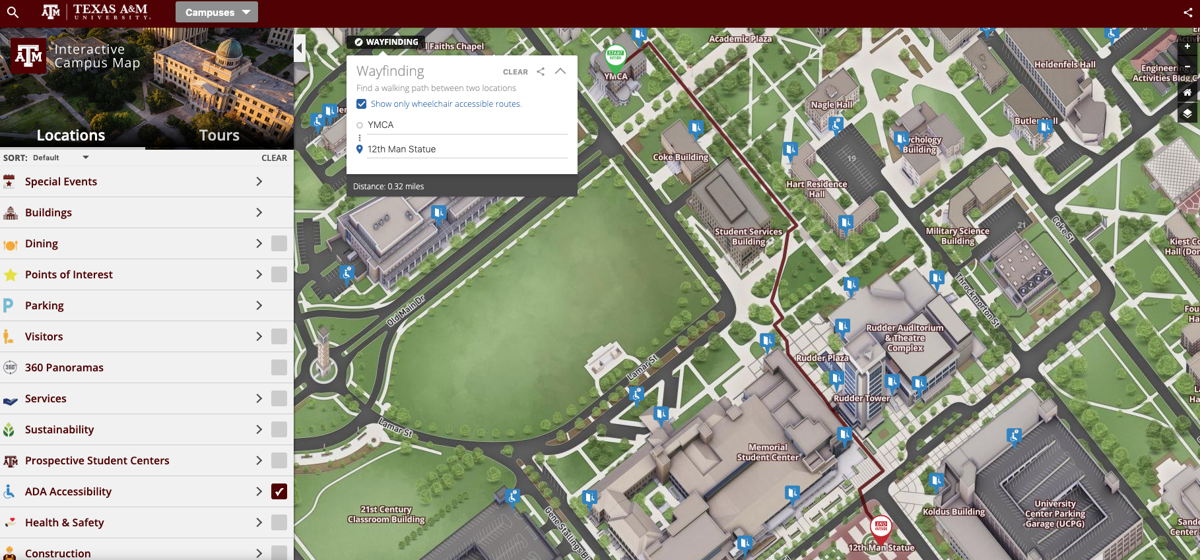
Texas A&M University integrated a new wheelchair accessible wayfinding feature into its interactive campus map, which helps identify the most efficient and easiest routes for those using a wheelchair. Although Texas A&M’s campus terrain is relatively flat, there are a lot of stairs, inclines and curb cuts that can present challenges for campus accessibility, and which were factored into the new wayfinding system.
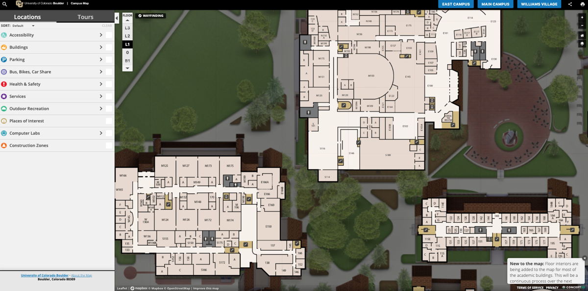
In order to make it even easier to find a specific location within a building, CU Boulder added a new feature that gives map users the ability to view the building interiors, floor by floor. The new interior floor map includes clearly marked room numbers as well as stairs and restroom locations on each floor.
To read more about the award winners and honorable mentions, visit: https://www.concept3d.com/blog/higher-ed/concept3d’s-most-innovative-higher-ed-campus-maps-of-2019
Founded in 2006, Concept3D is a leader in creating immersive online experiences with 3D modeling, interactive maps and VR-enabled virtual tour software. Concept3D software brings any physical location into an intuitive and navigable digital format, providing clients with a powerful competitive edge through applications like data visualization, wayfinding, immersive VR-enabled virtual tours, and real-time platform-wide updates. Concept3D clients include convention centers and event spaces, data centers, healthcare and retirement facilities, large commercial sites, resorts, hotels and theme parks, as well as universities and many other locations. Concept3D’s higher education system was formerly known as CampusBird. Learn more at https://www.concept3D.com.
