Asian Surveying & Mapping
Breaking News
China launches new set of classified Yaogan-43 satellites
HELSINKI — China launched a second group of classified...
China-Africa space cooperation benefits people across continent
The Egyptian satellite MISRSAT-2, a high-resolution optical remote-sensing satellite,...
Abu Dhabi astronomers discover new asteroid
ABU DHABI: The International Astronomical Centre in Abu Dhabi...
UAE’s First Private Space Infrastructure Company Launched by Marlan Space and Loft Orbital
Abu Dhabi-based Marlan Space, a new space company affiliated...
Japan’s space agency ends Moon probe operation
Japan's space agency said on Monday it had ended...
Chinese researchers assess U.S. space situational awareness, call for boost in China’s capabilities
HELSINKI — Chinese researchers are calling for improved space...
Japan’s Astroscale wins contract for space junk harvesting robotic arm
Japanese space debris cleaning outfit Astroscale revealed on Monday...
SpaceX rocket carries 2 Taiwan-developed satellites into space
Taipei, Aug. 17 (CNA) A Falcon 9 rocket launched...
Bayanat, Yahsat launch UAE’s first SAR satellite
California , August 17 (ANI/WAM): Bayanat AI PLC (ADX:...
Long March 4B launches experimental Yaogan-43 satellite group
HELSINKI — China successfully launched the first of a...

November 13th, 2019
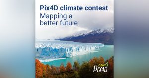
Help map a better future with Pix4D’s Climate Contest

Lausanne, Switzerland: Photogrammetry software company Pix4D has launched its first ever Climate Contest. People from around the world are invited to submit a project which uses mapping to investigate or mitigate the climate crisis for the chance to win up to a $3,000USD cash prize and access to Pix4D software.

From tracking melting glaciers in rural Kyrgyzstan, to counting the cost of storm damaged crops in Puerto Rico, to mapping chimpanzee nests in Tanzania, Pix4D software and #dronesforgood is already helping scientists and citizens prepare to meet the climate crisis. The Pix4D Climate Contest offers changemakers support to get their project off the ground.


  • The Pix4D Climate Contest is now open and is accepting entries until December 13, 2019. Winners will be announced by email in January 2020.
  • Climate change is a global problem, so entries are open worldwide. Any individual, group, business, school or organization can enter and projects don’t need to have started to be considered.
  • The judging panel includes Pix4D GIS-experts, environmental activists and a representative from Swiss Youth for Climate.
  • As well as a cash prize and access to Pix4D software, winners will receive personalised technical support and have their projects featured on pix4d.com.


For more information and to enter: https://www.pix4d.com/climate-contest
 

About Pix4D

Pix4D (pix4d.com) develops cutting-edge software that converts images taken by hand, by drone, or by plane into accurate and georeferenced survey-grade  2D mosaics, 3D models and point clouds. Founded in 2011, Pix4D is rapidly expanding from its headquarters in Lausanne, Switzerland, to offices in Berlin, Madrid, Denver, San Francisco, Shanghai and Tokyo.