NEWTON, MASSACHUSETTS (USA) – Caliper is pleased to announce that the State Legislative Districts Data Product is now available for the entire USA or for a single US state. Three area databases are provided that reflect the latest boundaries for Congressional Districts, State House/Assembly (lower chamber) districts, and State Senate (upper chamber) districts.
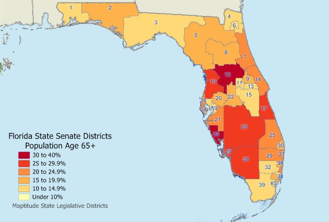
These layers are packed with essential information for corporate legislative affairs departments, lobbyists, political consultants, political parties, and anyone else involved in political affairs. Each legislative district includes 2010 Census counts for age, race, gender, ethnicity, and housing, as well as 2015 American Community Survey (ACS) data for income, occupation, education, language spoken, marital status, travel mode and time, housing value, and housing costs.
By using the legislative district data with Maptitude mapping software, you will be able to answer questions such as “In which districts are my addresses located?” or “In which districts should I expend the most effort?”
The price is $1,295 for the entire United States or $495 for a single state.
Caliper Corporation develops state-of-the-art Geographic Information Systems (GIS) software. With a focus on usability, Maptitude is designed to be a cost-effective, professional mapping software product. Maptitude enables organizations to leverage their location-based data to improve decision making and planning, while minimizing expenditure through competitively priced solutions.
Caliper is a privately held corporation and is a leading developer of mapping, redistricting, transportation, and GIS software.
