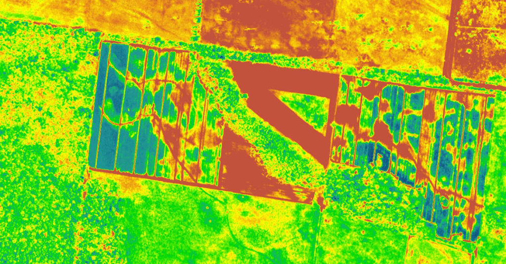
BEER-SHEVA, Israel – ImageSat International (ISI) and Ben-Gurion University of the Negev (BGU) announced a collaboration to leverage BGU’s breakthrough spectroscopy imaging research and develop a high performance, high resolution hyperspectral/ultraspectral imaging system with vast flight- and space-based remote sensing applications.
Remote sensing from space or aircraft has a wide range of applications including agriculture, climate and pollution monitoring, homeland security, and commodity exploration.
The compressive sensing technology utilized in this new camera system, which has been significantly miniaturized, requires only a tenth of the data traditionally needed to quickly produce high-resolution images.
The new camera system is based on the research of Prof. Adrian Stern, head of BGU’s Unit of Electro-Optical Engineering; Prof. Dan Blumberg, BGU vice president and dean of research and development; postdoctoral fellow Dr. Isaac August; and Ph.D. student Yaniv Oiknine, who developed a miniature ultra-spectral imaging system that is compact, simple to operate and more cost-efficient than current systems.
Spectroscopic imaging collects and processes information that can help isolate and identify “signature fingerprints” found in objects, chemical substances or material defects that are not detectable by the human eye. While the human eye generally sees color in three bands of light (red, green and blue), spectral imaging divides images into many more bands to capture additional data across the electromagnetic spectrum.
Hyperspectral imaging sensors measure the light reflected by the earth’s surface in different wavelengths, ranging from one- to several-hundred-per-pixel. This generates significant amounts of data that must be transmitted to the earth for processing, and may require enormous bandwidth.
“This new technology based on BGU research could lead to a new generation of spectral systems for flight and space-based remote sensing,” says Prof. Dan Blumberg. “The collaboration between academia and industry is a sterling example of the ‘NewSpace’ concept, which promotes innovation and creativity in the space industry and will enable ImageSat to become the leader in the field of hyperspectral imaging.”
About ImageSat International N.V.
ImageSat International (ISI) N.V. owns and operates very high-resolution earth resources observation satellites (EROS). A global leader in end-to-end geospatial solutions, the company specializes in satellite data extraction and analysis. ISIS offers NewSpace programming, with solutions and services that include mission ground segments, satellite imagery services, mapping and GIS, intelligence reports, intelligence analysis training, space-based persistent surveillance, total maritime awareness, agriculture and forestry, and geo-economics. The company, founded in 1997, is based in Or Yehuda, Israel. For more information, visit www.imagesatintl.com.
About American Associates, Ben-Gurion University of the Negev
American Associates, Ben-Gurion University of the Negev (AABGU) plays a vital role in sustaining David Ben-Gurion’s vision: creating a world-class institution of education and research in the Israeli desert, nurturing the Negev community and sharing the University’s expertise locally and around the globe. As Ben-Gurion University of the Negev (BGU) looks ahead to turning 50 in 2020, AABGU imagines a future that goes beyond the walls of academia. It is a future where BGU invents a new world and inspires a vision for a stronger Israel and its next generation of leaders. Together with supporters, AABGU will help the University foster excellence in teaching, research and outreach to the communities of the Negev for the next 50 years and beyond. Visit vision.aabgu.org to learn more.


