
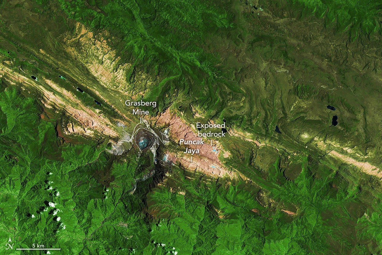
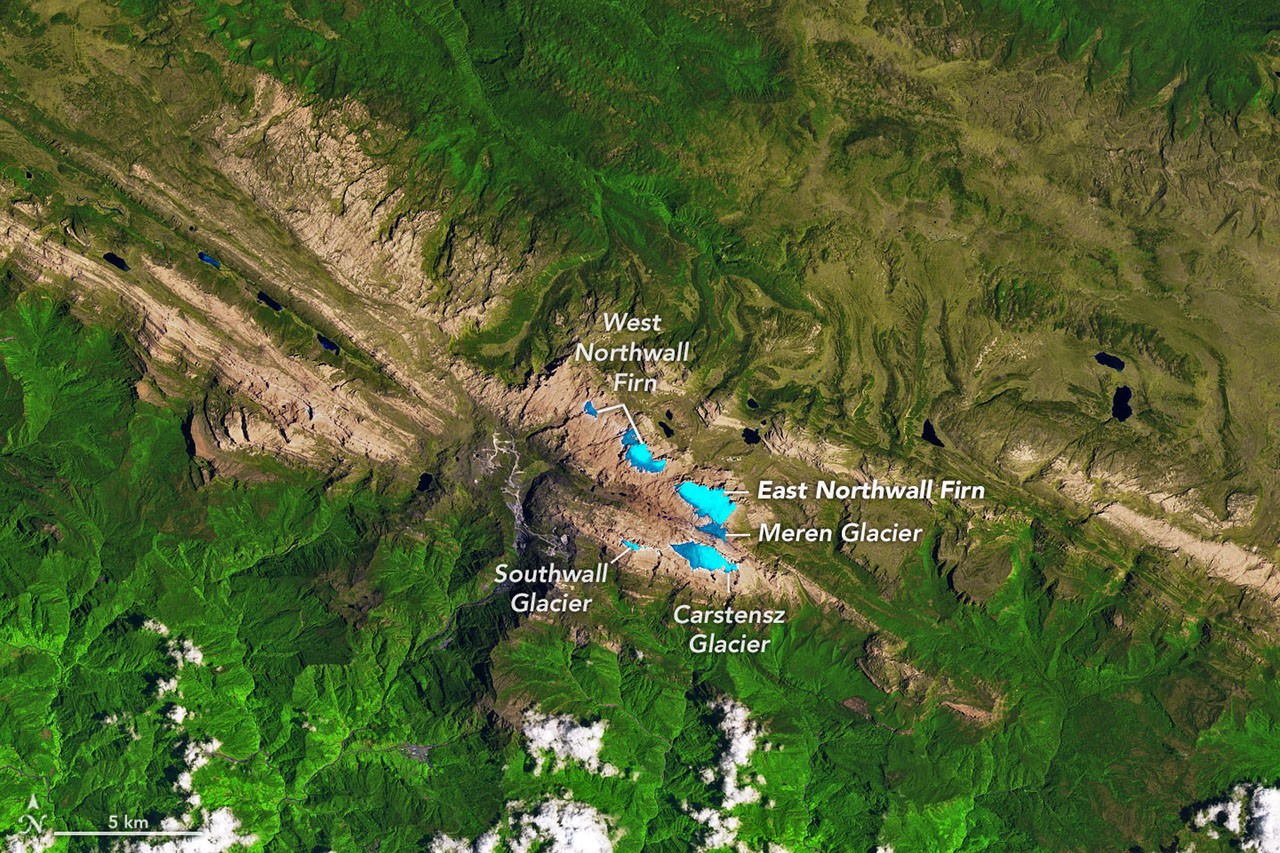
 New satellite imagery shows how dramatically the ice near Puncak Jaya in Indonesia’s Sudirman Range has retreated since 1988. A pair of false-color Landsat images—one from Landsat 5 in 1988 and another from Landsat 9 in October 2026—shows once-connected blue ice fields reduced to scattered fragments amid exposed brown rock.
Glaciers covered approximately 4.31 square kilometers (1.66 square miles) in 1988, according to Indonesian climate scientist Donaldi Permana. Satellite and aerial observations indicated that just 0.09 square kilometers (0.03 square miles) remained by September 2025, about 2 percent of the earlier extent. The remaining ice is so thin and fragmented that it no longer flows as an active glacier, researchers say.
A Landsat 5 false-color image from Nov. 3, 1988, (bottom) shows extensive ice near Puncak Jaya, while a Landsat 9 image from Oct. 19, 2026, (top) shows only scattered ice patches.
The high-elevation ice is especially vulnerable to warming and El Niño conditions, which can bring rain instead of snow and expose darker surfaces that absorb more solar energy. The comparison illustrates the scale of the long-term retreat, while an aerial survey planned for December is expected to help establish how much ice remains in 2026.
Image Credit: NASA Earth Observatory images by Lauren Dauphin, using Landsat data from the U.S. Geological Survey.
