Asian Surveying & Mapping
Breaking News
Japan Eyes Sovereign D2D Satellite Network
Japan plans to select a proposal this month for...
China schedules Long March 10B rocket launch and recovery attempt
HELSINKI — China is set for a debut flight...
BRICS space agencies meet begins in Bengaluru
Heads and senior representatives of the space agencies of...
“India’s growing space ecosystem to drive global collaboration”, says ISRO Chairman V Narayanan after BRICS Space Agencies Meeting
"India's growing space ecosystem to drive global collaboration", says...
UAE aims to see Emirati on Moon in next 10 years, says MBRSC chief
UAE expects to have a presence on the Moon within...
Safran, SatSure partner to develop geospatial intelligence solutions for India
French aerospace giant Safran Electronics & Defense and Indian...
Singapore unveils road map to help develop international business standards and conformance
Singapore has unveiled plans to help develop international standards...
Adelaide University to run space and defence venture launchpad ahead of Australian Space Forum
Adelaide University’s Innovation & Collaboration Centre (ICC) will deliver...
Japan’s H3 rocket returns to space with successful launch after December setback
Japan’s flagship H3 rocket has returned to flight six...
KONGSBERG accelerates seabed mapping developments with Ocean Exploration Trust expedition aboard Exploration Vessel Nautilus
KONGSBERG and the Ocean Exploration Trust (OET) are set...

December 16th, 2025
New Timing for Stubble Burning in India 

Every year for decades, long rivers of smoke and haze have spread across the Indo-Gangetic Plain in northern India from October to December. That’s when farmers in Punjab, Haryana, Uttar Pradesh, Madhya Pradesh and other states burn off plant “stubble” after the rice harvest. 

When winds are weak and the atmosphere becomes stagnant, the haze can push levels of air pollution several times higher than limits recommended by the World Health Organization. Smoke typically mixes with particles and gases from other sources, such as industry, vehicles, domestic fires (heating and cooking), fireworks and dust storms, to form the haze, though scientists consider stubble burning to be a major factor. 

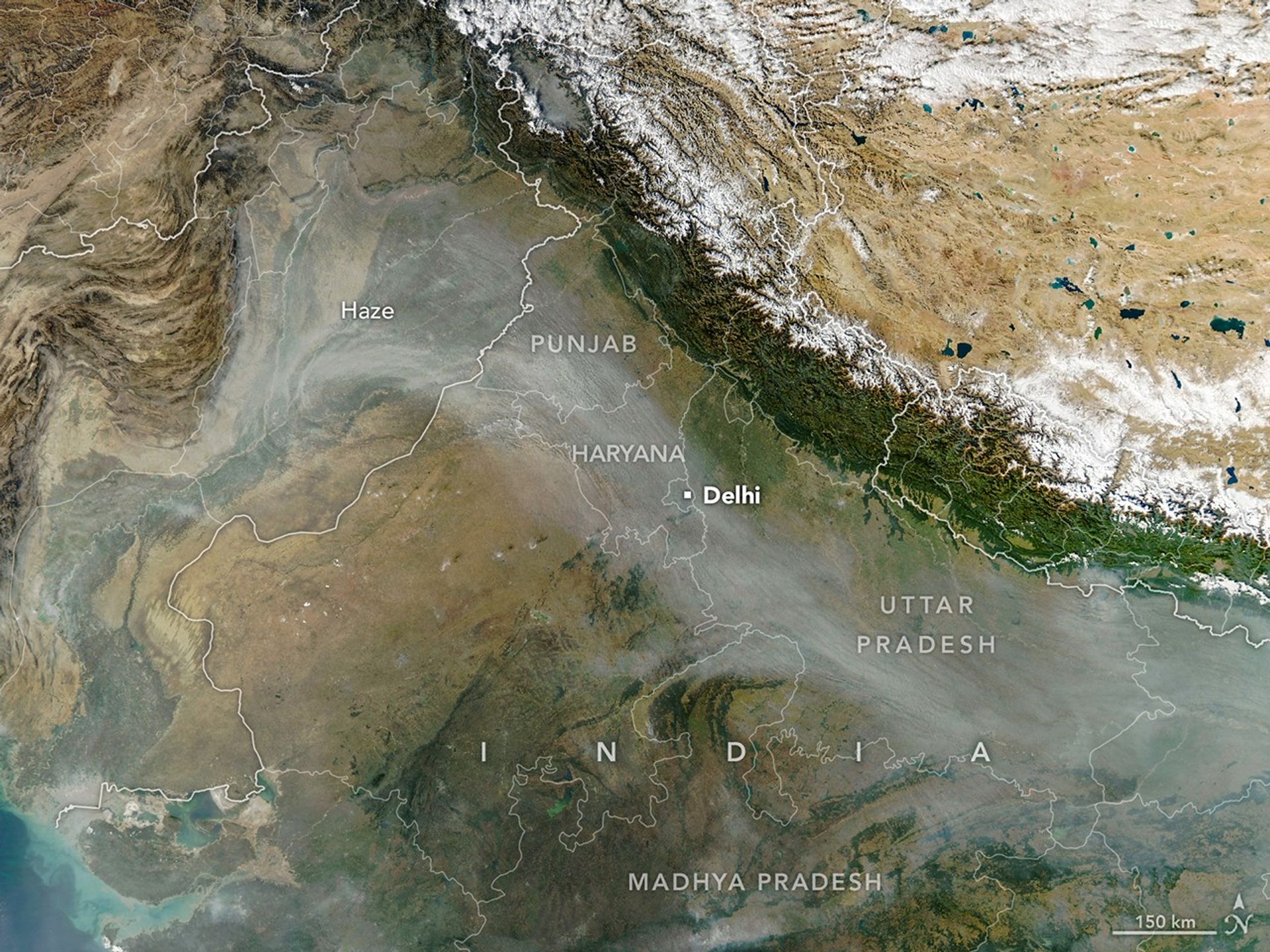
The MODIS (Moderate Resolution Imaging Spectroradiometer) on NASA’s Aqua satellite captured this image of a smoky haze darkening skies over much of the plain on Nov, 11, 2025. According to news reports, it was the first of several days in 2025 when pollution levels exceeded 400 on India’s air quality index, the strongest rating on the scale. As in past years, the poor air quality prompted officials in some areas to close schools and institute more stringent air quality controls on construction. 

Image Credit: NASA Earth Observatory image by Michala Garrison, using MODIS data from NASA EOSDIS LANCE and GIBS/Worldview.