Asian Surveying & Mapping
Breaking News
Safran, SatSure partner to develop geospatial intelligence solutions for India
French aerospace giant Safran Electronics & Defense and Indian...
Singapore unveils road map to help develop international business standards and conformance
Singapore has unveiled plans to help develop international standards...
Adelaide University to run space and defence venture launchpad ahead of Australian Space Forum
Adelaide University’s Innovation & Collaboration Centre (ICC) will deliver...
Japan’s H3 rocket returns to space with successful launch after December setback
Japan’s flagship H3 rocket has returned to flight six...
KONGSBERG accelerates seabed mapping developments with Ocean Exploration Trust expedition aboard Exploration Vessel Nautilus
KONGSBERG and the Ocean Exploration Trust (OET) are set...
Russian satellites linked to mysterious GPS disruptions across several countries
Since 2019, GPS signals across Europe, Greenland and Canada...
Isro’s Bahubali LVM3 that launched Chandrayaan-3 to be handed to private sector
IN-SPACe has invited Indian companies to take over the...
India to host 13th UN Global Geospatial Information Management Asia-Pacific Conference
India is hosting the 13th United Nations Global Geospatial...
Unseenlabs’ BRO-22 to Become the First Foreign Private Satellite Launched Aboard Japan’s H3 Launch Vehicle
Scheduled for June 10, between 09:53 and 11:52 a.m....
PLD Space increases investment in its Launch Complex at the Guiana Space Centre (CSG) to €35M, strengthening Europe’s sovereign space infrastructure
The investment is expected to generate approximately €21 million...

October 28th, 2025
Expedition on E/V Nautilus to Explore Deep Waters of the Cook Islands 

Located in the South-Central Pacific, the Cook Islands is comprised of 15 islands surrounded by more than 770,000 square miles of ocean, the vast majority of which remain unmapped and unexplored. 

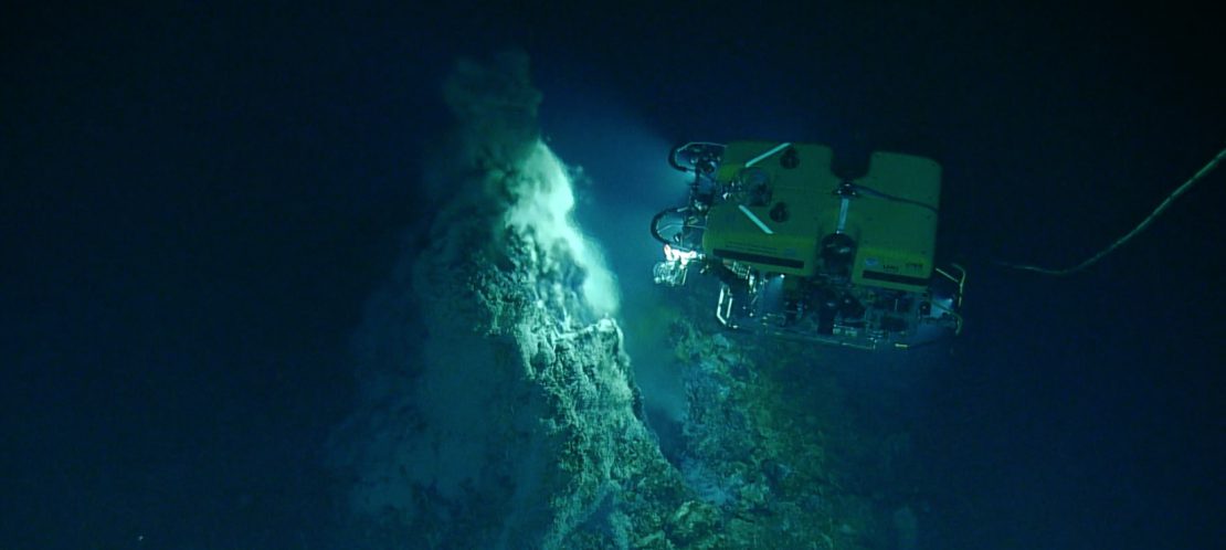
During the expedition, mapping, telepresence and remotely operated vehicle systems on E/V Nautilus will allow the collection of high-resolution visual observations of the seafloor, as well as environmental data and physical samples, to support studies on the biological and geological context of abyssal plain habitats and the Manihiki Plateau. All data collected during the expedition will be made publicly available, helping support ongoing local management and future decision-making by Cook Islanders. 

Learn more at https://NautilusLive.org. 

Image Credit: Ocean Exploration Trust