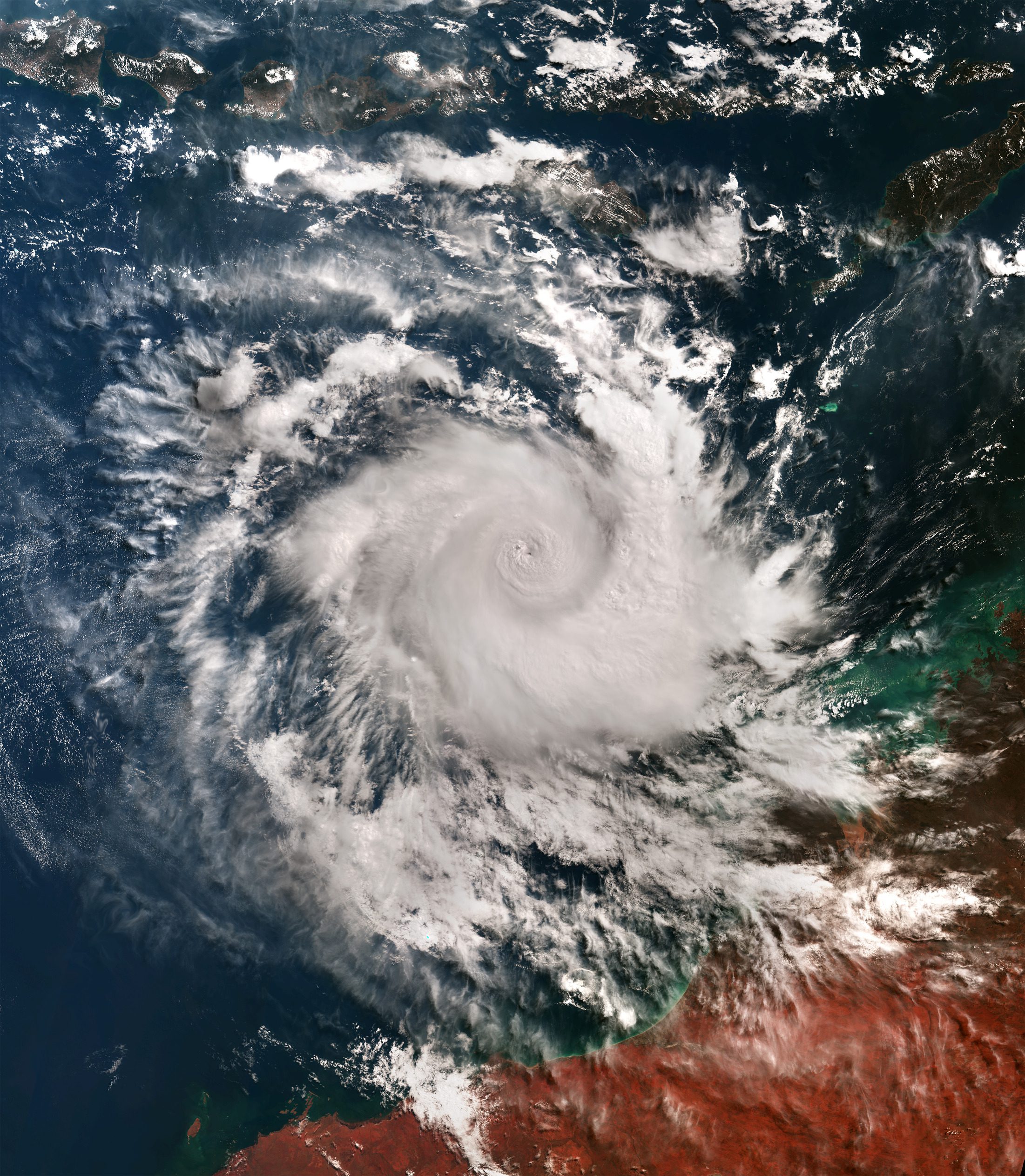
On April 16, 2025, when this image was acquired by Copernicus Sentinel-3’s Ocean and Land Colour Instrument, Cyclone Errol reached its peak intensity with wind gusts of 285 km/h. The typical pinhole eye—a small, well-defined eye often associated with powerful and rapidly intensifying tropical cyclones—is clearly visible in the image.
Despite its intensity, Errol quickly weakened the following day, as it moved toward Australia. This limited its impact and damage on land to heavy rains in remote areas of the Kimberley region coast, which is visible in the cloud-free portion at the bottom of the image.
Image Credit: Contains modified Copernicus Sentinel data (2025), processed by ESA
