
Saturday, March 19th, 2011
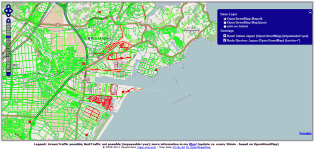
A dynamic map overlay showing the Road Status after the Earthquake in Sendai, Japan, based on the user generated maps from OpenStreetMap has been generated by Pascal Neis, member of the GIScience Research Group of the University...

Wednesday, March 16th, 2011
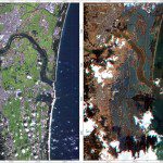
The images were acquired by the German Optical RapidEye and radar TerraSAR-X satellites. They show Torinoumi on the eastern coast of Japan before the disaster on 5 September 2010 and after the tsunami on 12 March 2011....
Tuesday, March 15th, 2011
The Russian-English Agricultural Atlas is the world’s most comprehensive source of information on the geographic distribution of plant-based agriculture in Russia and neighboring countries. The Atlas contains 1500 maps that illustrate the distribution of 100 crops, 560...
Sunday, March 13th, 2011
RapidEye has acquired two scenes over the West Coast of Honshu Island on Marth 12th. The satellites are already tasked again to image on Sunday, March 13th. The Center for Satellite Based Crisis Information (ZKI) which is part...

Sunday, March 13th, 2011
Detailed satellite images of the territory of Japan were received, where a series of earthquakes were registered on March 11 in its north-eastern parts. According to the Main Meteorological Service of the country the 8.9 magnitude earthquake...
Saturday, March 12th, 2011
In response to the devastating Japan earthquake and tsunami, Esri is providing assistance to a myriad of organizations involved in the disaster response. The company is working closely with both domestic and international...
Friday, March 11th, 2011
The center of Space Monitoring will start to operate at the Urals Federal University. Opening ceremony of the Center and putting into operation of the Earth remote sensing data reception station is to be held on March...
Wednesday, February 23rd, 2011
Autodesk, Inc. a leader in 3D design, engineering and entertainment software, announced the expansion of its Clean Tech Partner Program to Japan. The Japan program marks the first step in a planned expansion into Asia Pacific. The...
Tuesday, February 22nd, 2011
At 12:51 p.m. on February 22, 2011 a magnitude 6.3 earthquake hit the South Island of New Zealand near the city of Christchurch. The Esri distributor in New Zealand, Eagle Technology Group in collaboration with Environment Canterbury has...