Tuesday, April 19th, 2011

Tuesday, April 19th, 2011
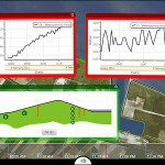
Coastal countries and municipalities are reinforcing their protective walls by building higher and higher dikes, but the problem is usually not their height. The dikes are simply too weak. An early warning system whose data can be...
Tuesday, April 19th, 2011
SuperGeo Technologies announce that SuperGIS Server 3, its comprehensive enterprise Server GIS software, supports online editing function for efficient editing and updating large map data. SuperGIS Server 3 is a set of comprehensive enterprise GIS software which...
Wednesday, April 13th, 2011
Tuesday, April 12th, 2011
SuperGeo Technologies is pleased to announce its latest distributor in the Middle East. KIRRA for Mapping and GIS (KIRRA) is officially authorized to distribute SuperGIS series software exclusively in Saudi Arabia. KIRRA is sited in Riyadh, the...
Tuesday, April 12th, 2011
Trimble announced today that it will demonstrate how its new cloud-based field service solution—Trimble GeoManager WorkManagement—integrates with Microsoft Dynamics CRM at Microsoft Convergence 2011. Trimble WorkManagement is a software solution that provides on-demand visibility into vehicle and...
Monday, April 11th, 2011
ERDAS proudly announces the introduction of the all-new ECW for ArcGIS Server, which provides a means for ArcGIS Server 10 to deliver Enhanced Compression Wavelet (ECW) data to clients via OGC-compliant Web Coverage Service (WCS)...