Thursday, October 18th, 2018
FRANKFURT, Germany — Trimble (NASDAQ: TRMB) announced today the launch of the Trimble® Nomad® 5 handheld computer—the next generation of its rugged Nomad series of handhelds. Built for tasks such as data collection, asset management and inspections, the...
Thursday, October 18th, 2018
FRANKFURT, Germany—Trimble (NASDAQ: TRMB) announced today a new version of its Inpho office software suite for photogrammetry. The suite includes two new capabilities: MATCH-3DX software for the creation of rich 3D point clouds and true orthomosaics...
Thursday, October 18th, 2018
DENVER - Concept3D, (https://concept3d.com) a leader in creating immersive online experiences with 3D modeling, virtual reality (VR), interactive maps and virtual tour software, today announced that CoreSite (https://www.coresite.com) has launched the Concept3D platform with a virtual tour...
Thursday, October 18th, 2018
Penn’s top energy policy award—the Carnot Prize—will be given to the Honorable Shri Piyush Goyal, India’s former minister of power and renewables and current minister of railways and coal. During his tenure, Goyal directed a fast-track effort...
Thursday, October 18th, 2018
NORCROSS, GA. – Hexagon’s Geospatial division announces a new version of M.App Enterprise for 2018, M.App Enterprise 16.5. This privately-hosted solution allows organizations to deploy Hexagon Smart M.Apps that dynamically address their location-based business problems. M.App Enterprise...
Thursday, October 18th, 2018
(Heerbrugg, Switzerland – 18 October 2018) – Leica Geosystems, part of Hexagon, announced today the availability of Leica Chiroptera 4X and Leica HawkEye 4X. The latest upgrades introduce a new bathymetric LiDAR high resolution technology that increase the...
Thursday, October 18th, 2018
Trade show sees launch of Index Partners Network, standards mapping tool to aid Singapore manufacturers. Read More at The Business Times
Thursday, October 18th, 2018
(Heerbrugg, Switzerland ) – Leica Geosystems, part of Hexagon, announced today the launch of the new manual total stations, the Leica FlexLine series. Building on the FlexLine series legacy of quality, durability and low total cost of ownership,...
Wednesday, October 17th, 2018
China sent twin BeiDou-3 navigation satellites into space on a Long March-3B carrier rocket from Xichang Satellite Launch Center in Sichuan Province at 12:23 p.m. Monday. Read More at Inside GNSS

Tuesday, October 16th, 2018
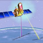
The Megha-Tropiques satellite was built by the Indian Space Research Organisation (ISRO) and the French National Centre for Space Studies (CNES) as a joint venture. The satellite is meant to study water cycle and energy exchanges in...