Wednesday, November 6th, 2019
BEIJING – China on Sunday launched a new high-resolution remote sensing satellite capable of providing stereoscopic imagery, state-run media said, marking another important step as Beijing seeks to reduce reliance on foreign technology in topographic mapping. Read...
Wednesday, November 6th, 2019
Pacific island countries vulnerable to climate change will benefit from space technology to help them plan for and prevent natural disasters, thanks to a new UK and Australian partnership. Read More at Business Leader
Wednesday, November 6th, 2019
SHENZHEN, China - China's leading express delivery giant SF Express have announced the launch of multiple new intercontinental scheduled flight operations. The newly launched Wuxi-Chongqing-Frankfurt Hahn-Wuxi three weekly schedule flights consolidates the company's goal to expand its international...
Wednesday, November 6th, 2019
Lawrence, MA – DARWin SP Data Acquisition software is included with every SPECTRAL EVOLUTION spectrometer and spectroradiometer. The software controls the instruments and provides additional capabilities via pull down menus. Now, DARWin SP Data Acquisition software offers...
Wednesday, November 6th, 2019
SUNNYVALE, Calif. - Trimble (NASDAQ: TRMB) introduced today the Trimble® R12 GNSS receiver, a high-performance Global Navigation Satellite System (GNSS) surveying solution. Powered by an all new Real Time Kinematic (RTK) and Trimble RTX® positioning engine, it features...

Tuesday, November 5th, 2019
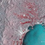
This image shows the extent of flooding on Japan’s main island of Honshu. Captured by the Copernicus Sentinel-1 mission, the image shows the floods in red around the cities of Sendai and Ishinomaki on Oct. 12, 2019....
Tuesday, November 5th, 2019
CANBERRA, Australia - GEO Week 2019 -- Earth Science Information Partners (ESIP), the global community steward for Earth science data professionals, today announced Operational Readiness Levels (ORLs) to make Earth science data more trusted and to improve data-driven decision-making...
Tuesday, November 5th, 2019
Herndon, Virginia — The United States Geospatial Intelligence Foundation (USGIF) is excited to announce a variety of events taking place November 18 through 23 as part of its 2019 GEOINT Community Week. USGIF’s annual GEOINT Community Week brings...
Tuesday, November 5th, 2019
ROSSLYN, Va. - Orbital Insight announced today its partnership with Booz Allen, to deploy artificial intelligence (AI) algorithms on its new software platform, Modzy. The U.S. executive branch and DoD have called for the rapid adoption of...
Tuesday, November 5th, 2019
CHC Navigation has launched its LT700H RTK Android tablet, designed to increase efficiency and productivity of the mobile field workforce in applications requiring centimeter-to-decimeter positioning accuracy. Photo: CHC Navigation Portable, rugged and versatile, the LT700H enables precision...