Thursday, November 12th, 2020
Sensor technology for vision is evolving. Following in the footsteps of ultrasound and lidar sensors, mmWave Radar is the next generation of vision sensor technology about to hit the mainstream market. Cameras and Lidar sensors have been...

Tuesday, November 10th, 2020
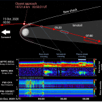
The Japan Aerospace Exploration Agency (JAXA) and European Space Agency (ESA) measured the trajectory of the Mercury Magnetospheric Orbiter, known as “Mio,” and the Mercury Planetary Orbiter (MPO) following the Venus flyby on Oct. 15, 2020. The...
Tuesday, November 10th, 2020
Kleos Space S.A. (ASX: KSS, Frankfurt: KS1), a space-powered Radio Frequency Reconnaissance data-as-a-service (DaaS) company, is proud to announce the successful deployment of its Scouting Mission satellites (KSM1) following the launch on India's Space Research Organization's (ISROs)...
Tuesday, November 10th, 2020
MONTREAL - Local Logic, a location intelligence platform that provides powerful insights for homebuyers, real estate professionals, and developers, today announced that it has raised a total of $8 million CAD ($6.1 million US) in funding. The funding...
Tuesday, November 10th, 2020
WASHINGTON - New Light Technologies Inc. (NLT) is partnering with NoBrainerData to develop and provide clients with innovative data-driven solutions in the field of predictive demography and population dynamics. NLT is a leading provider of data analytics, geospatial,...
Tuesday, November 10th, 2020
ORLANDO, Fla.- Red Cat Holdings, Inc. (OTC: RCAT) ("Red Cat" or the "Company"), a leading brand in the drone industry, today announced completion of the acquisition of Fat Shark Holdings, Ltd. ("Fat Shark"), the leading provider of...
Tuesday, November 10th, 2020
REDLANDS, Calif.- Esri, the global leader in location intelligence, today announced the launch of the ArcGIS Field Maps mobile app. ArcGIS Field Maps is an all-in-one app that uses data-driven maps to help mobile workers collect and...
Tuesday, November 10th, 2020
Montreal, Canada – SimActive Inc., a world-leading developer of photogrammetry software, announces the release of Correlator3D™ version 8.6. The new version includes multiple new features, such as the use of intensity data from LAS files for image...
Tuesday, November 10th, 2020
Will Lead Conservation Innovation Center (Annapolis, MD) – Today, Chesapeake Conservancy announced that Susan Minnemeyer has been promoted to the role of vice president of technology. Minnemeyer joined the nonprofit in February 2019 as a geospatial program...
Tuesday, November 10th, 2020
Lausanne, Switzerland, : Pix4D, the photogrammetry industry leader, announces today the release of a new app product for ground images acquisition: Pix4Dcatch. Pix4Dcatch empowers users to easily create ground-based 3D models using an iOS mobile...