Wednesday, February 24th, 2021
UK Space Agency’s International Partnership Programme (IPP) and Ecometrica’s Forests 2020 Platform fuel industry initiative Edinburgh/Mexico City – The long-term sustainability of Mexican palm oil production has been given a major boost with the announcement that...
Tuesday, February 23rd, 2021
SAN JOSE, Calif.- Cepton, a leading provider of intelligent, lidar-based solutions, and the Austrian Industry and Testing Alliance ALP.Lab have partnered to build lidar-equipped testing environments for studying complicated road driving situations. For the first time in Austria, this...
Tuesday, February 23rd, 2021
CAESAREA, Israel - infiniDome Ltd., the GPS Security Company, today announces the successful completion of UAS flight trials conducted under GNSS jamming scenarios. The test flight was part of the NA’AMA initiative, a project to push the boundaries of...
Tuesday, February 23rd, 2021
The GEOINT Community Forum offers insights around advances in modeling, simulation, and gaming technology Herndon, Virginia — The United States Geospatial Intelligence Foundation (USGIF) and the Open Geospatial Consortium (OGC) bring you the first GEOINT Community Forum...
Tuesday, February 23rd, 2021
CGI (NYSE: GIB) (TSX: GIB.A) was awarded by the European Space Agency (ESA) a contract to develop a new wildfire mapping service that combines recent advances in Earth Observation (EO), Artificial Intelligence (AI) and cloud computing to help better...
Tuesday, February 23rd, 2021
SIMI VALLEY, Calif -AeroVironment, Inc. (NASDAQ: AVAV), a global leader in unmanned aircraft systems, today announced it had completed its acquisition of Arcturus UAV, Inc. a leading designer and manufacturer of high-performance unmanned aircraft systems (UAS). The approximately $405 million...
Tuesday, February 23rd, 2021
Ottawa, CA: Kongsberg Geospatial announced today that it has been selected by Defence Research and Development Canada (DRDC) to conduct trials of a new long-endurance UAV surveillance system for the Canadian Coast Guard. The MartinUAV V-BAT aircraft was...
Tuesday, February 23rd, 2021
Process Petabytes in Minutes MARKHAM, Ontario, Canada – CATALYST, a PCI Geomatics brand, today introduced CATALYST Microservices, a library of geospatial workflows and algorithms optimized to process Earth image data on the cloud at scale. “The...
Tuesday, February 23rd, 2021
Montreal, Canada, February 23rd, 2021 – SimActive Inc., a world-leading developer of photogrammetry software, announces the use of its Correlator3D product by Chasco Constructors in Texas for monitoring construction. The project was performed by the Virtual Design...

Monday, February 22nd, 2021
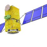
PSLV-C51, the 53rd mission of ISRO’s PSLV, will launch Amazonia-1 of Brazil as the primary satellite with 18 co-passenger satellites from Satish Dhawan Space Centre (SDSC) SHAR, Sriharikota. The launch is tentatively scheduled for Feb. 28, 2021,...