Friday, April 26th, 2019
AUSTIN, Texas - Slingshot Aerospace, an advanced analytics company, today announced $5 million in new seed funding. The round was led by ATX Venture Partners with participation from new investor Revolution’s Rise of the Rest Seed Fund....
Friday, April 26th, 2019
Kongsberg Geospatial, an Ottawa-based geospatial visualisation software company, and MicroPilot, world leader in professional UAV autopilots, announced today that the Kongsberg Geospatial IRIS UxS Fleet Control Station has been integrated with the MicroPilot MP2x28 series of autopilots...
Friday, April 26th, 2019
SHANGHAI - Ambarella, Inc. (NASDAQ: AMBA), a Santa Clara, California-based developer of high-resolution video processing and computer vision semiconductors, and Momenta, an autonomous driving technology company based in Suzhou, China, today announced a collaborative HD mapping platform for...
Friday, April 26th, 2019
The Geological Remote Sensing Group (GRSG) has entered into an agreement with PCI Geomatics that will allow active GRSG Student Members to gain access to the company’s powerful Geomatica image processing software, for a full year. PCI Geomatica software...
Friday, April 26th, 2019
SOUTH JORDAN, Utah--Nearmap, a leading provider of high-resolution aerial imagery, is strengthening HNTB’s ability to create lifelike, 3-D, HD-quality visuals and models to win business against larger competitors. Using Nearmap’s timely and accurate aerial imagery throughout the...
Friday, April 26th, 2019
WASHINTON, D.C., USA — Hexagon’s Geosystems division announced today the HxGN Content Program, providing access to ortho imagery for professional use, is releasing about a quarter million square kilometres of new 15-centimetre resolution aerial imagery of metropolitan...
Friday, April 26th, 2019
ORANGE BEACH, Ala. — Team TBG ProTech Oceans Program Manager Michele Finn, a retired captain from the National Oceanic and Atmospheric Administration (NOAA) Commissioned Officer Corps, was selected to be part of the international leadership initiative Homeward...
Friday, April 26th, 2019
New facility to develop large solid rocket motors Will be the newest and most modern rocket development facility in the nation Latest chapter of ongoing partnership with state and local community CAMDEN, Ark.- Senior Aerojet Rocketdyne officials...

Wednesday, April 24th, 2019
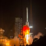
China successfully launched a new navigation satellite, Beidou-44, on April 20, 2019. The launch took place from the LC3 Launch Complex of the Xichang Satellite Launch Center, Sichuan province, using a Long March-3B/G2 launch vehicle. The satellite...
Wednesday, April 24th, 2019
Cheseaux, Switzerland, April 24 2019 – senseFly, the leading provider of fixed-wing drone solutions—in collaboration with drone engineering and consulting specialists AL Drones and geotechnology company Santiago & Cintra—is excited to announce that the National Civil Aviation...