Thursday, February 20th, 2020
Jack Dangermond, Founder & President of Esri, to keynote before joining Joe Astroth, CEO of Cyclomedia USA; Robert Mankowski, VP of Digital Cities at Bentley Systems; Michel Stanier, EVP of Teledyne Geospatial; and Jim Van Rens, Senior...
Thursday, February 20th, 2020
DENVER, Colorado, USA – LAND INFO Worldwide Mapping LLC, the premier provider of mapping solutions for 5G wireless in North America, has assembled a world-class team of geospatial companies to extend its reach in the 5G industry...
Thursday, February 20th, 2020
Heerbrugg, Switzerland – Leica Geosystems, part of Hexagon, announced today the new Leica Nova TS60, the world’s most accurate total station, with newly integrated DynamicLock and AutoHeight features. The new version of theTS60 total station is now...
Wednesday, February 19th, 2020
sensemetrics Inc., a California-based Industrial IoT (IIoT) and cloud technology company transforming sensor data into real-time business intelligence, today announced that Geosense, a leading UK manufacturer of geotechnical and structural monitoring instrumentation company, is the first sensor...
Wednesday, February 19th, 2020
MOUNTAIN VIEW, Calif. - Matternet, a pioneer in drone delivery for medical applications, announced the company's partnership with Robotic Skies, a global maintenance network for commercial Unmanned Aircraft Systems (UAS), to provide field service and repair support...
Wednesday, February 19th, 2020
Laser Technology, Inc., Redefines Data Collection with Hybrid Measurement Technology. Laser Technology, Inc., a manufacturing company specializing in laser speed, distance, and measurement devices, has announced the release of a new measurement tool within their Professional Measurement...

Tuesday, February 18th, 2020
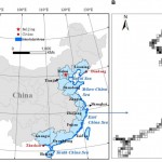
Using archives of satellite imaging data, a study in Frontiers in Earth Science has conducted the most in-depth study of China’s intertidal wetlands to date and found a 37.62% decrease in area between 1970 and 2015. Intertidal...
Tuesday, February 18th, 2020
The new version of Leica Nova MS60 enables users to perform all surveying tasks with one instrument (Heerbrugg, Switzerland, 18 February 2020) – Leica Geosystems, part of Hexagon, announced today the new Leica Nova MS60. The MS60 MultiStation,...
Tuesday, February 18th, 2020
Bushfire disasters and satellite water monitoring are crucial targets in new projects announced by Australia’s largest ever space research program. The SmartSat Cooperative Research Centre based in South Australia today announced some of the first projects...
Tuesday, February 18th, 2020
Southeast Asia’s inaugural geospatial event set to return on 24th-25th March 2021 Singapore – Following the cancellation of Geo Connect Asia 2020, in view of health and travel safety concerns connected to the still-evolving Covid-19 situation, organisers...